Google Earth Engine ( GEE ) is a cloud platform for processing satellite imageries. This service includes images of Landsat 5, 7,8, Sentinel 1 and Sentinel 2. You can process them directly on Google servers and don’t need download the images. This opportunity does processing of satellite imageries faster then on a limited desktop PC. However, you should have programming skills, because this is based on JavaScript code and the Google Earth Engine API.
Examples of GEE
A great example of using this servic is Global Forest Watch. The main task of this service are interactive maps of deforestation and reforestation. I really advise you to look up on this resources if you does not heart about them already.
Project with GEE
Now, I want to describe my practical experience using GEE. This is related with my master project. Topic of the project is “Determination of burning area in Arkhangelsk region (Russia)”. The Arkhangelsk region covers half million km². Creating a cloudless composite covering the whole region is not a simple task and very time consuming if it is done manually: You will spend more time on downloading images and picking up images in the composite.
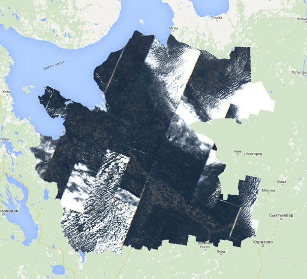
Composite of Landsat 5 snaps for August of 2011.
But I think the result showing on figure 1 miss some areas as they are covered by clouds. I developed a method for improving this image composite result: Method for creating composite
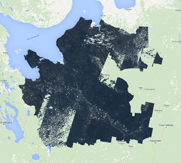
After running this, the clouds where removed from the composite. Luckily I was able to fill those areas with pixel information from other scenes/months.
Results of cloud removal method
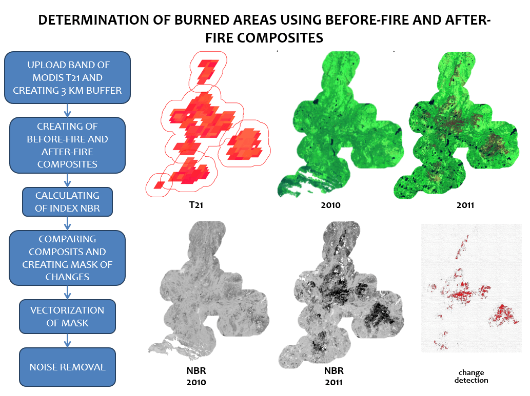
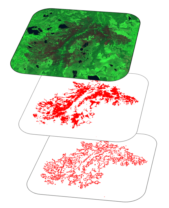
I created two composites: For example, first was created from imageries from 2011 and second was created from 2012. Afterwards I calculated Normalized Burn Ratio (NBR) spectral index for ever composite, downloaded these calculated images on my computer and uploaded them in a software called ScanEx Image Processor to determine changes. The picture below shows scheme of this algorithm.
This script was used.
Method for determination burned areas
GEE has some good tutorial and excellent examples for learning here.
Although this is only the top of the iceberg and you can find more information on the GEE forum.
I didn’t try to describe it all in detail, but I want to note your attention on the opportunities in using GEE. I am not a programmer but I have some basic knowledge in programming.
If you are reading this post – you might know something about satellite imagery. This is a valuable source to power quite a lot of analytics and monitoring…
Sentinel is the buzzword for a series of Earth observation missions like Sentinel-1 (Land and Ocean monitoring,launched in April 2014), Sentinel-2 (land monitoring, launched in June 2015) and…
Thanks to a post from the mapbox colleagues I’ve found out that new Landsat 8 scenes are already available on EarthExplorer. The data is great!!! 0 0 votes…
I want to continue my article “Using the Google Earth Engine (GEE) for Detection of Burned Areas” (link) and describe in detail script for detection burned areas. I decided…


You link to the GEE forum which is invitation only…. Tease!
Fantastic Alexander, thanks for posting this.
Jane, You can send request and get access. It’s not problem.
link to gee script please
Owwwwww! Very good application. I’ve never seen one exaple with GEE!
Can we do script with python?
Yes you can script with Python, the system supports both Javascript and Python