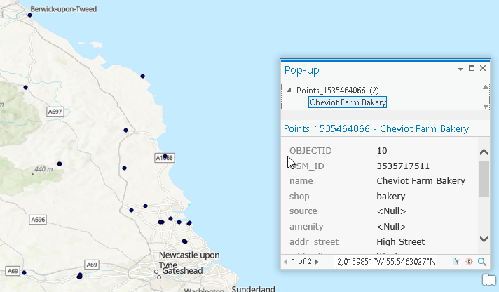
Playing Around With ArcPY…
I was playing around with ArcPY and tried to recreate a version of the qgis2leaf plugin just for ArcGIS just to get to know that ArcGIS doesn’t seem to have native support for GeoJSON. So I’ll not show you how to build a leaflet map from within ArcGIS but I would like to show you some basic tasks in ArcPY by exporting a point shapefile to a CSV.short announcement: TopoToolbox 2: Geomorphometry made easy in MATLAB
< p align=”justify”>Digital elevation models (DEMs) exist today for the entire globe with consistent quality. Improvements in sensors and data processing give a clue that in the future elevation data will be available in even better spatial resolution and accuracy. Discovering the richness of information inherent in DEMs should thus be supported by good software. Here, I want to give a brief account of TopoToolbox 2, the second version of a MATLAB toolbox for exploring and analyzing DEMs. Dirk Scherler from Caltech and I have been working on many changes to the previous version to make TopoToolbox faster, more memory…