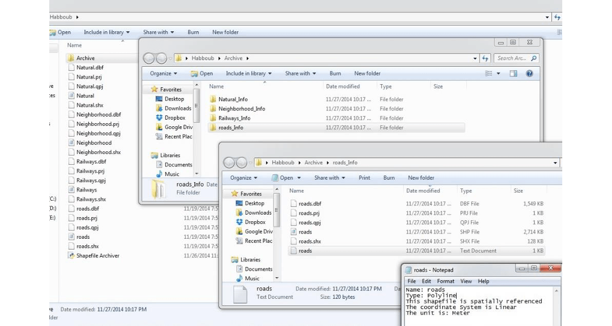
A small tool with Python: the shapefile archiver
Let me introduce to you, guys, my first Python tool: “Shapefile Archiver”. Usually, I face lots of problems in managing my shapefiles. My first problem is backing them…
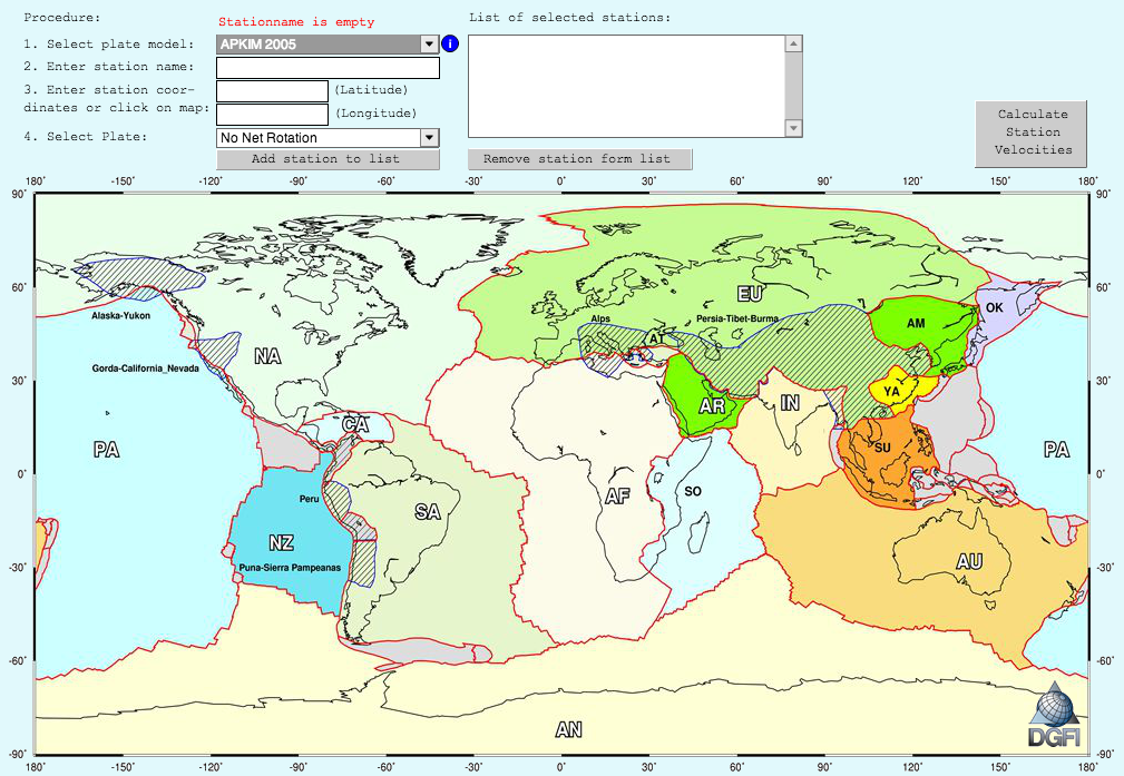
The german geodetic research institute provides a visualizer to retrace the distribution and movement of our continental and oceanic plates. The tool represents the plates models: NUVEL-1, NNR-NUVEL-1,…