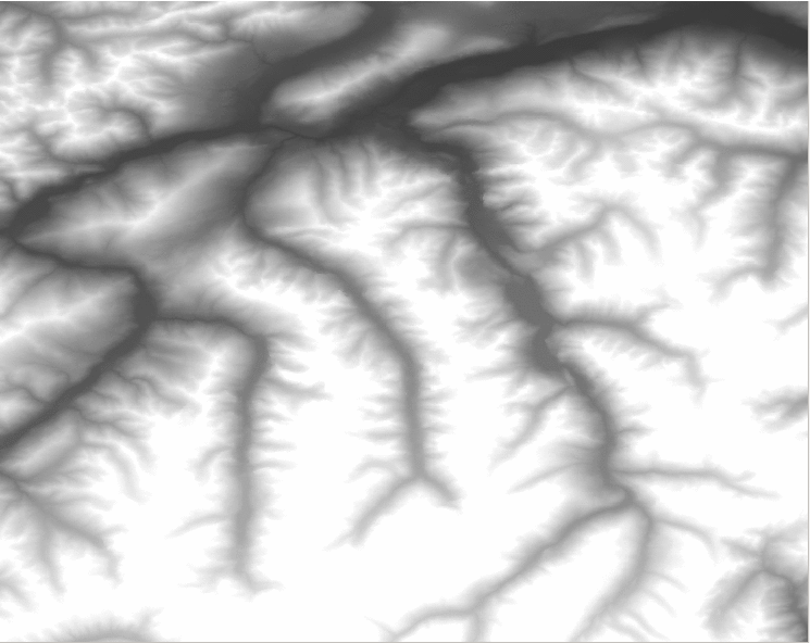
Beautiful Watershed Polygons in QGIS
As the title sugests I am showing you, how to create beautiful watershed polygons. We will start with some raster files and use a nice GRASS tool for…
An article from Anders. Geodata in javascript GeoJSON is the standard way of storing geodata in JSON, javascripts native data format. The wikipedia article has very clear and…
The Ordnance Survey is UK’s mapping agency and frequently releases free datasets. Their OpenData policy is quite progressive compared to Germany’s and they’ve recently published some fresh datasets…
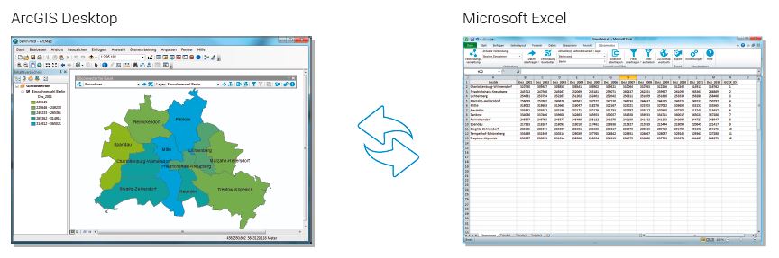
GISconnector for Excel – the beginning of a beautiful friendship between ArcGIS and Excel The GISconnector transforms ArcGIS and Excel into an ingenious overall system: The power of…
Today I’ll start with a new series of tutorials for an open Source GIS called “ILWIS GIS“. ILWIS is the short term for “Integrated Land and Water Information System”…
I just found a nice web interface for converting Shapefiles to geoJSON, the preferred format of vector geodata on the web. And yes, you can also convert back…

A short time ago I’ve posted an article on the installation of QGIS in combination with a PostGIS database in the background. As we all know, Windows is…
In the last tutorial we have created a very basic web-map using OpenLayers and one web-mapping service from OpenLayers itself. In fact using OpenLayers seems to me like…
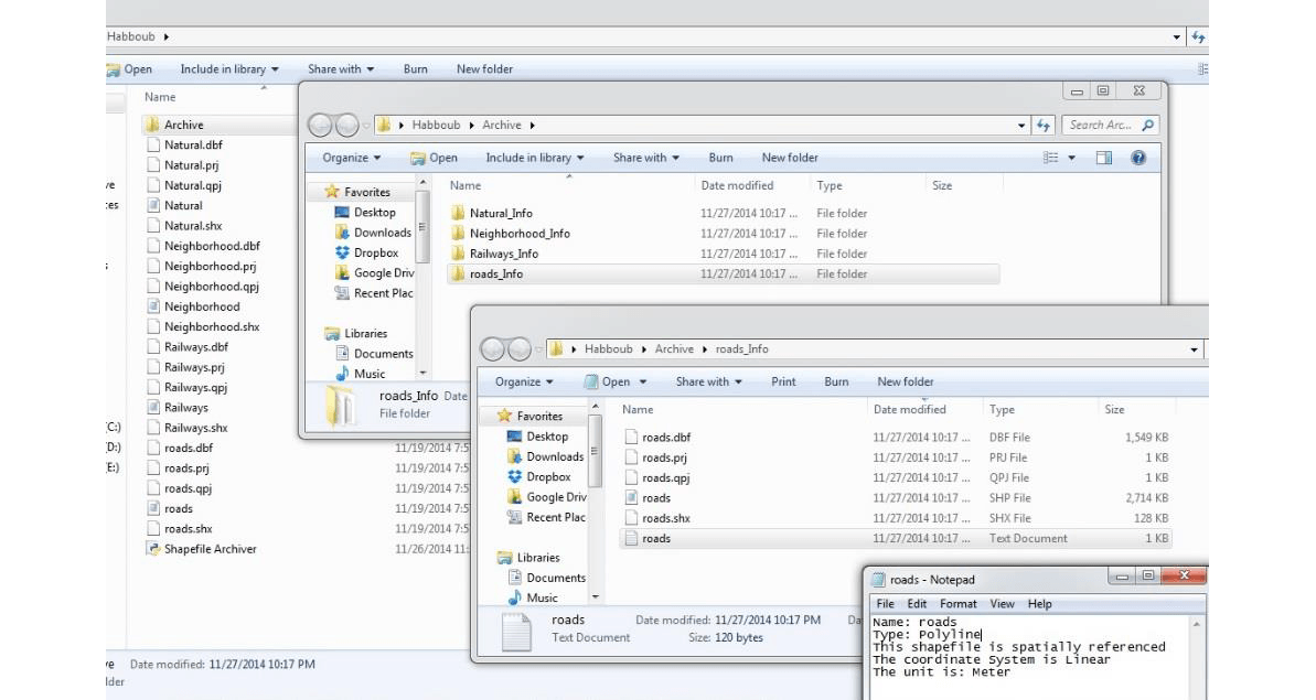
Since we have managed to get a very simple web-map running on our website, it may be a need for some persons to distribute their own shapefiles using…
If I would like to adjust a shape file I normally used the way over an excel file or a text file to get a table and to…