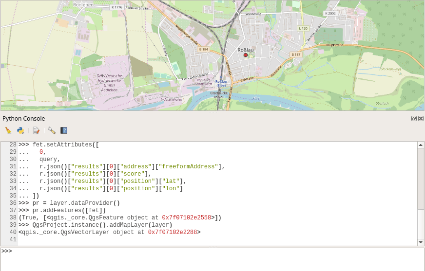
Geocoding with Microsoft’s Azure Maps
API’s are getting more and more important as some (maybe the majority?) of GIS users don’t want to handle large datasets, don’t want to care about addresses and…
For a geomorphological study that I am working on I want to produce topographic swath profiles across a mountain range, that is, I want the average elevation along…

The Ordnance Survey is UK’s mapping agency and frequently releases free datasets. Their OpenData policy is quite progressive compared to Germany’s and they’ve recently published some fresh datasets…
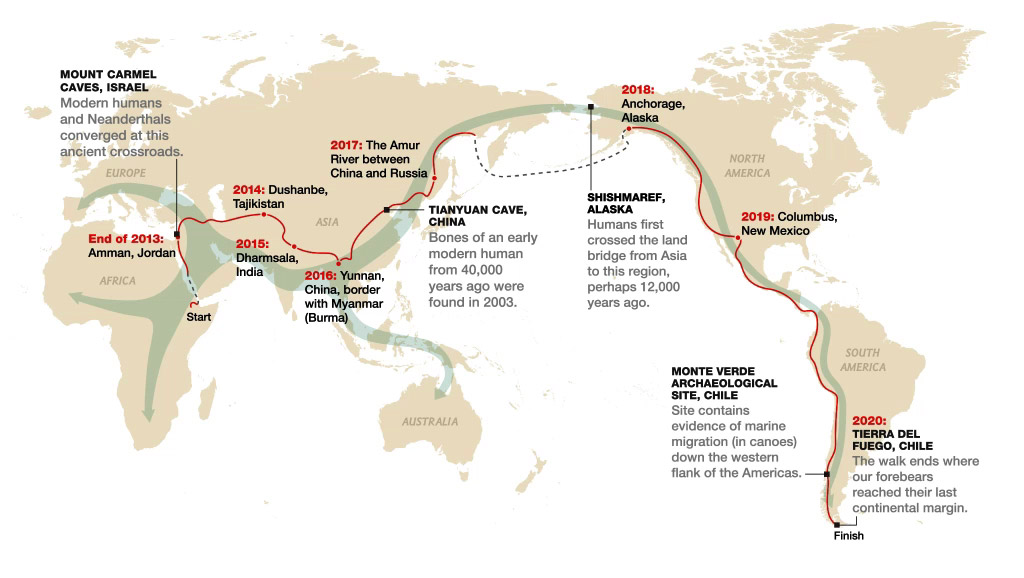
Today I had the chance to attend a lecture by Paul Salopek in Tbilisi, Georgia. This lecture took me to the idea to write a short review about…
Digital’s digest – This new post series gives you a weekly overview about new exciting geo-, project- and gis-links. We should write about a special link? Please submit…
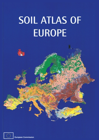
If you are working on European soils, I’m sure you already know the website of the European Union Joint Research Center, the so called ‘European Soil Portal‘. If…
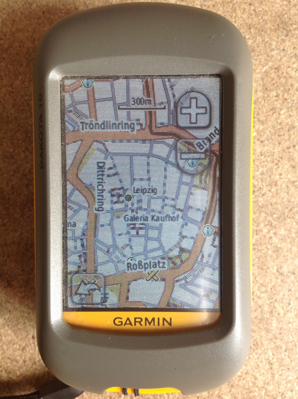
Since most people working with digital-data they are always interested in obtaining their own data using a Global Positioning System (GPS). Therefore I’ll give a short introduction for all…
Thanks to Christoph, he also runs a specific blog on paleoseismicity, who send me the link, I want to share the gizmodo list of best maps 2013 with…
There were some rumors in the blogosphere about the new program of National Geographic Society. But one thing first as it is more important: Our good old friend…