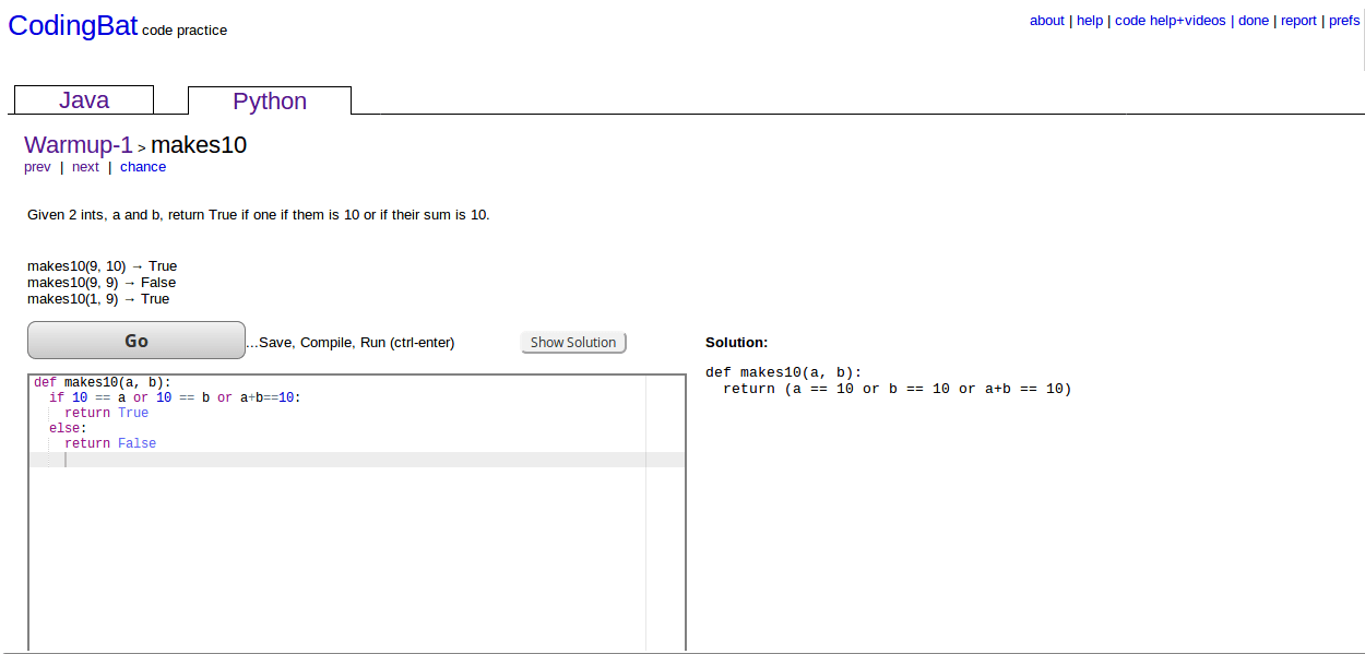
How to use OpenStreetMap, guides for beginners and advanced users on LearnOSM.org
OpenStreetmap is the fastest growing community mapping project of all times. Beside the “normal” map result, what you can use for your daily navigation through cities and countries like Google Maps, OpenStreetMap allows you to get the geodata and use it for your own ideas and projects (with some licence regulations). For many peoples the difficult part is not getting the data but the usage and adoption. Therefore the Humanitarian OpenStreetMap Team created LearnOSM.org.
short announcement: ESRI MOOC – the outline
As we already informed here about the new ESRI MOOC (Massive Open Online Course) we also stated, that it is a pitty that there is no schedule available. Due to this there might be a mismatch between people’s expectations and the content of the MOOC. We also got the information that this MOOC is not for the GIS beginners.short announcement: learn to map with cartoDB
Dear folks, most of you probably know how to map things using software on your pc. Some of you might also know cartoDB. We like their service as our job-page here on digital-geography.com is based on their tables, API and GeoJSON export functionalities. Additionally it’s for free (with some limitations)… The guys from CartoDB now offer an online learning event which will give newbies the chance to map their data in a very interesting online mapping engine.
NeoCartography and the need to code
The time when I studied Geography and Mathematics is long ago. So I chose Cartography as one major part of my studies and learned to draw circles and a good cartographic representation of discrete values as an example. As I have chosen this field of cartography and GIS I am well aware of the changes that came to this fields. Especially Cartography made big leaps to be more represented by Geoinformatics than those traditional map makers. And I would assume that it is hard for Geographers and Cartographers to catch up with all those fancy programming stuff. Nevertheless I think…
unsupervised classification in QGIS: kmeans or part two
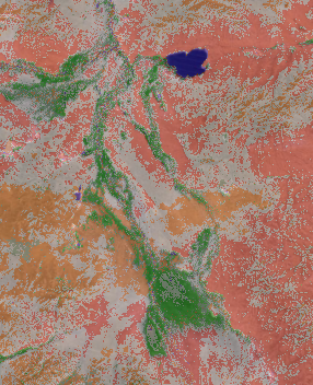
As I have already covered the creation of a layer stack using the merge function from gdal and I’ve found this great “plugin” OrfeoToolBox (OTB) we can now move one with the classification itself. I’ll show you how to obtain this in QGIS.
short announcement: learn to create maps online
This week a new 5 weeks course will start at coursera. Coursera is an online learning platform that enables people from all around the world to learn and to develop skills. This week we will see the first cartography related course to start: Maps and the Geospatial Revolution by Dr. Anthony C. Robinson First Session will start with a short historical view on maps and technologies together with some basic questions: how do we navigate, what is geography and the simple statement: “The Earth is Round and Maps are Flat” Session two will cover the concept of a scale, dimensional…
introduction to R: learning by doing (part 2: plots)
Lets go one with the second part of learning R by doing R (you will find the first part here. As we have used vectors, matrices and loops in the first part, we will concentrate on graphics in this one. but first we will need data to plot:
introduction to R: learning by doing (part 1)
Geography is often about statistics as it is the basis for fast exchange of information: providing a mean and standard deviation to the audience is often much easier then showing raw data: Learning a script language for this purpose can be a hard-ass work. But I think it is more often a need of practice. And by practice I mean typing, reading and trying out.
Geodatabases
In my years at the university i was playing around with a lot of data. These were sorted “somehow” and totally distributed. after a short while i have lost control and my pc behaved like HAL… One advice: USE GEODATABASES! YOu can see here how to do that using ArcCatalog