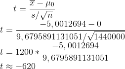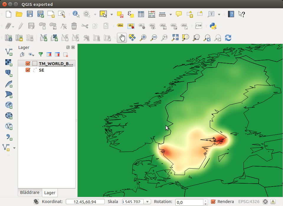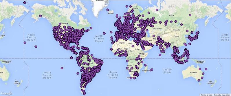
The Geography of Tweets: Reading Tweets with QGIS
Anita showed some nice examples of tweets in QGIS in 2012. Since then it seemed to be quiet about the twitter-content in QGIS. Yet tweets can be an…
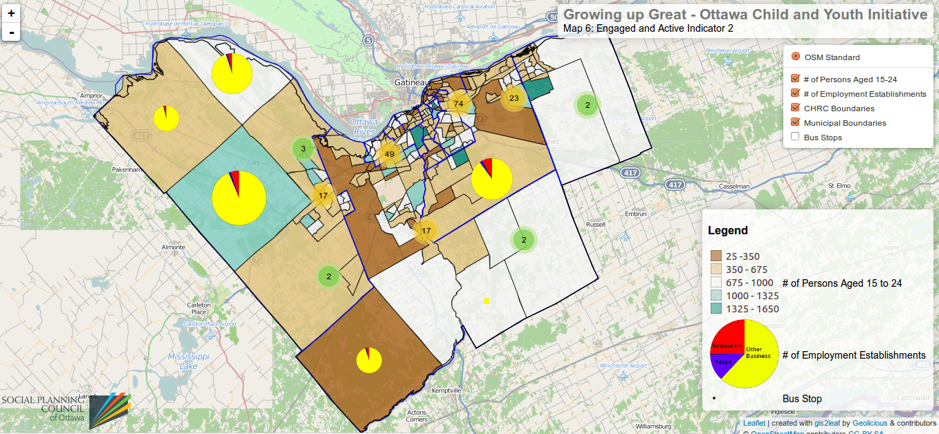
The Ordnance Survey is UK’s mapping agency and frequently releases free datasets. Their OpenData policy is quite progressive compared to Germany’s and they’ve recently published some fresh datasets…
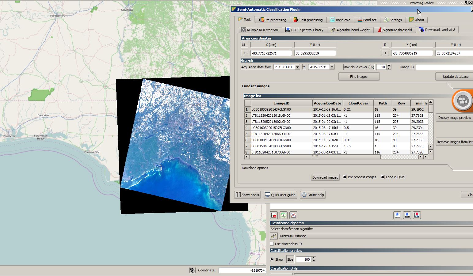
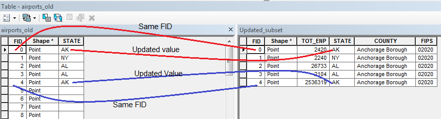
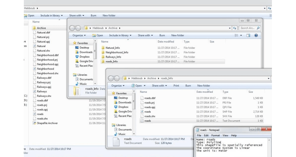
After my first attempt in Python scripting using opensource Geospatial Data Abstraction Library (GDAL), I wanted to use ArcPy in my second trial. The following code is so…