Mapalomalia: First web geological modeling platform
Mapalomalia lets geologists create and visualize 3D geological models from their browsers. It’s a free to use geological modeling platform. I hope people will use it to convey information about…
Mapalomalia lets geologists create and visualize 3D geological models from their browsers. It’s a free to use geological modeling platform. I hope people will use it to convey information about…
Ever since I have seen those fantastic geological cross sections cutting straight through the alps, I am fascinated by geological models, be it 1D, 2D or (nowadays most…
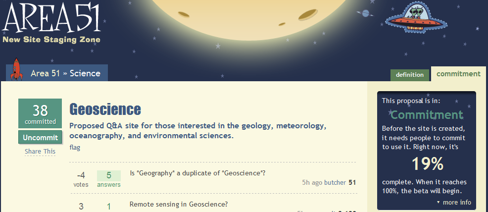
Most of our readers probably came along the sites of stackexchange or stackoverflow. But most questions regarding geosciences are discussed in local forums or with friends but not…
In some countries, such as the USA and Spain, there is a very nice law that makes life easy for geoscientists. This law guarantees free access to a…