GISgirls – where are the women? 4 theses
Typically GIS and geodata nerds are male. Anyhow, 99.9 % of our contacts, freelancer sign ups, comment writers here on the blog are boys. But where are the GIS girls and women? There must be thousands of well educated, very interested hackathon-proven GIS ladies out there. In order to getting in touch with that obviously shy species, I formulated 4 theses about GISgirls. Hopefully many active GIS and geodata girls (and women) will read that and comment in the bottom section. I would be very happy to get your feedback!
Map a whole city with OpenStreetMap
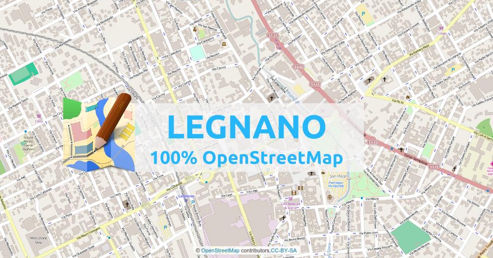
One day last month, I came back to OpenStreetMap, to see how the city of Legnano (city of 60k people – near Milan – Italy) was mapped. I knew I did not find much, but hoped it would have been mapped to a large extent. I immediately created an atlas with the online tool mapOSMatic and the result can be found here: Download PDF Atlas of Legnano (as it was) or go to the repository mapOSMatic I always talk about OpenStreetMap on my blog and I invite and teach all kinds of mapping. When I realized the state it was in my city,…
How to organize geodata storage?
In the past I’ve learned one thing: the only chance to do efficient geodata-projects is to have a clean data structure.
In this post I’ll show you some tools and share my thoughts about organizing (geo)data to have more efficient project-workflows. After that I would be very interested in your solutions and approaches to do smart data-projects.
Short Announcement: New Catalog for Geodata
You probably know Robin Wilson‘s list of free GIS data which is a great ressource if you search for specific datasets. He also is the creator of a blog concentrated on Python. But Karen Payne publishes a list which is quite impressive as well.Short Announcement: new MOOC on GeoInt!
Today I received an interesting E-mail from Pennstate University which pointed towards an upcoming MOOC with a more or less special focus: Geospatial Intelligence. The title is Geospatial Intelligence & the Geospatial Revolution: Learn how the revolution in geospatial technology combined with the tradecraft of Geospatial Intelligence (GEOINT) have changed how we develop insights about how humans use geography, and discover the power of GEOINT. So let’s have a look at.short announcement: Berlin geodata downloadable…
I don’t know what’s wrong with the governmental insitutions in Germany/Berlin: They have this law, that all the geodata are somehow under an open license but to me it’s always a little hard to find it. Once you’re on the website you need to visit the site of Geodateninfrastruktur (GDI)->Geodienste to find sources for WFS, WMS or downloadable data: Once you find it, lots of data is waiting for you! you can get historical maps for Berlin, DOM and DEMs (in 2 and 5m ground resolution), soil key figures, ground water tables and other stuff. In the end you can…Geoscience Australia – geodata collection via WMS, WFS and WCS
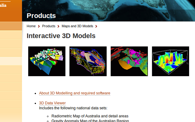
The Australian government now provides a bunch of commercial and free geodata on their Australia Geoscience-Portal. Like the well known U.S. data provider Earth-Explorer, you can do a product search, browse the full collection of data and application or find new released datasets. Besides this common features of data portals, the site offers a great collection of processed maps, datasets and really nice interactive models for geoscientific issues of Australia via WMS, WFS and WCS (Web Coverage Service).
INSPIRE conference wants your ideas and works
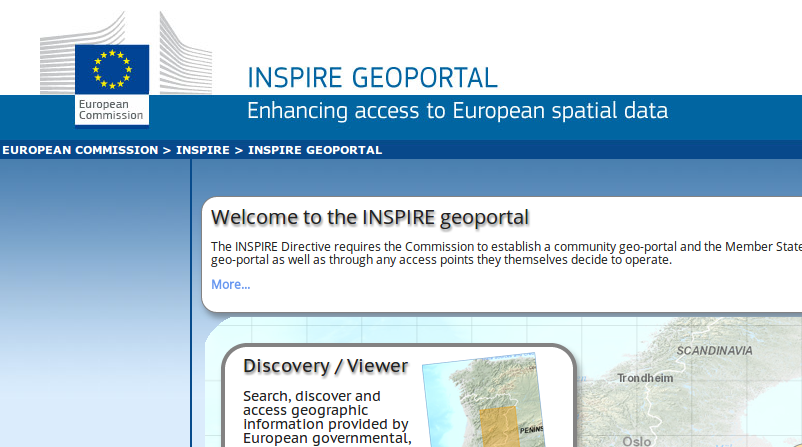
Aalborg in Denmark will be a place to be in the middle of June as INSPIRE rocks the city. The initiative “Infrastructure for Spatial Information in the European Community” commonly known as INSPIRE will have their annual meeting/conference in the northern part of Denmark.
short announcement: Government shutdown affects geosciences
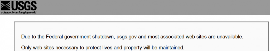
Thanks to a comment on our facebook page: Due to the conflict in state finances in the U,S and A gesocientists are affected: data providers like the USGS and their websites like landcover.org and others are unavailable!
short announcement: huge categorized list of geodata
Thanks to @seandebasti who enjoyed this year’s “Society of Cartographers Annual Conference” at Staffordshire University who send us a short link on Twitter. The link provides a huge list of 319 freely usable geodata catalogues. Robin who created this list put it on the table via linkedin first and was highly “liked” for this. He covers several topics: Elevation Weather and Climate Natural Disasters Land Cover/ Land Cover Ecology and many more … If you’re interested in his activities you may also want to check Robin’s blog. He blogs about GIS, Cartography and also tutorials with a wide view. You…
How to find geospatial data for Spain
In some countries, such as the USA and Spain, there is a very nice law that makes life easy for geoscientists. This law guarantees free access to a broad range of geospatial data like DEMs, satellite imagery, aerial photographs, ground use data, hydrological information and so on. In most cases, these data are made public via web-based GIS applications. These are generally rather slow, but allow to display a lot of different datasets. I did both my diploma thesis and my PhD in Spain and I really needed to find out about all the data available. I knew that they…