I don’t know what’s wrong with the governmental insitutions in Germany/Berlin: They have this law, that all the geodata are somehow under an open license but to me it’s always a little hard to find it. Once you’re on the website you need to visit the site of Geodateninfrastruktur (GDI)->Geodienste to find sources for WFS, WMS or downloadable data:
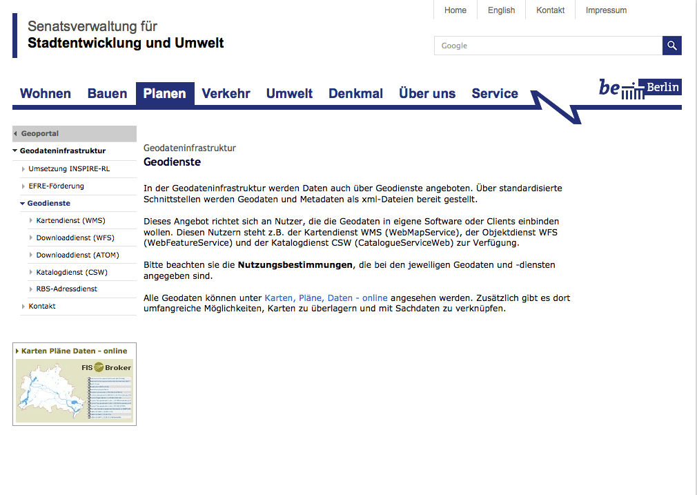
Once you find it, lots of data is waiting for you! you can get historical maps for Berlin, DOM and DEMs (in 2 and 5m ground resolution), soil key figures, ground water tables and other stuff. In the end you can get access to over 800 data sets using this long list of links…
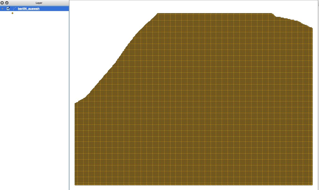
And working with LIDAR data can be lots of fun but also a damn hard session for your workstation:
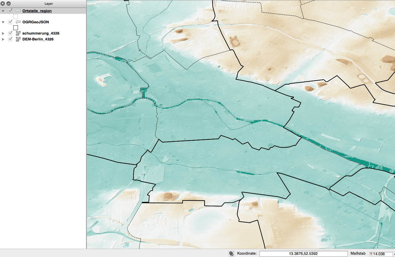
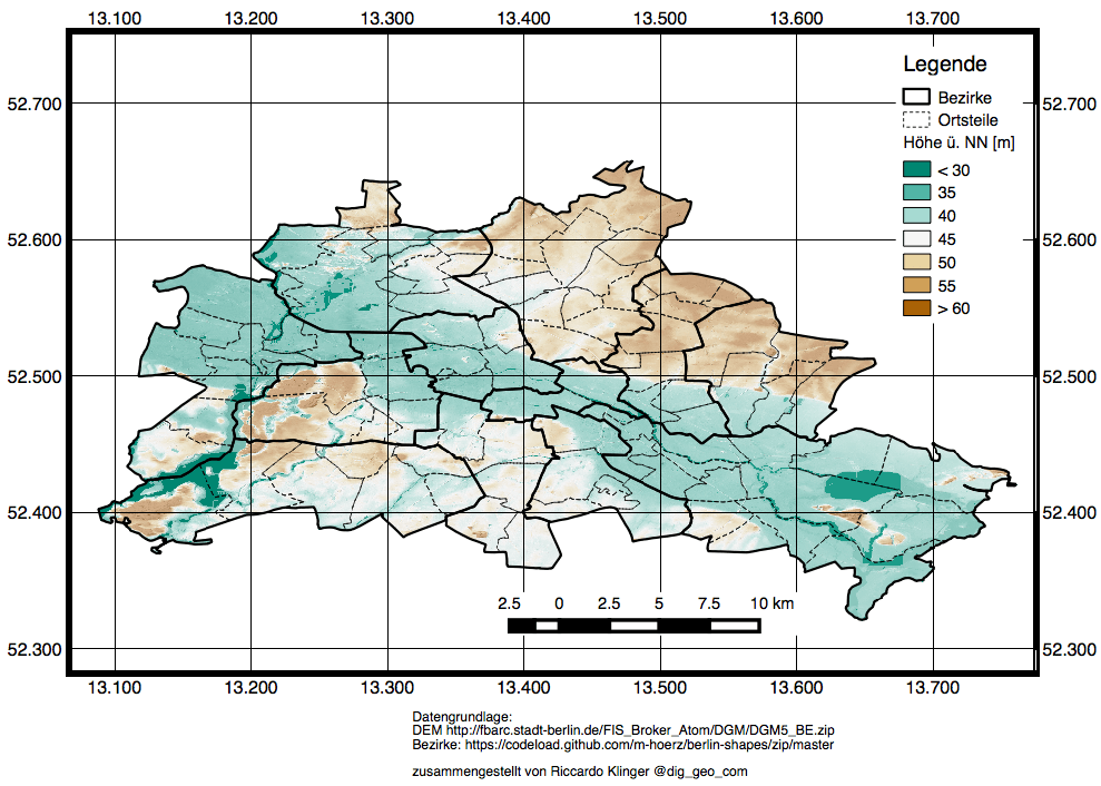
A big thank you to Tobias Preuß who pointed us to this data:
Berlin – Digitales Höhen Modell (DGM) – Ein erstes Zwischenergebnis. @underdarkGIS @dig_geo_com #fisbrokerberlin pic.twitter.com/fPjGi9nWlA
— tbsprs (@tbsprs) 5. Juli 2014

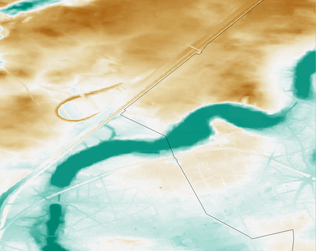
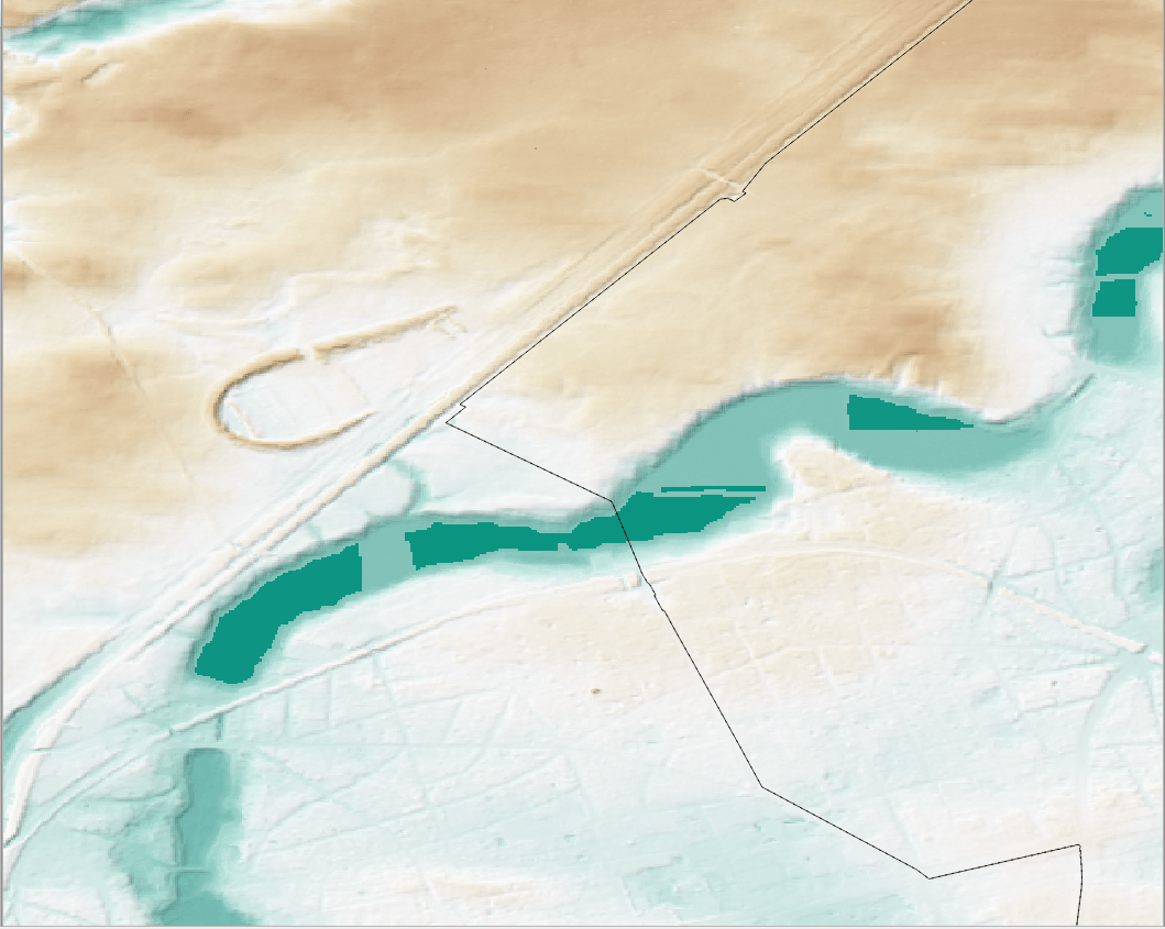
[…] geodata department of the city of Berlin offers a great portfolio of free geodata for everyone to use. One dataset is the result of some LIDAR measurements and is offered as a txt […]
[…] Click to view slideshow. […]
[…] geodata department of the city of Berlin offers a great portfolio of free geodata for everyone to use. One dataset is the result of some LIDAR measurements and is offered as a txt […]