I have been busy working on new post based on performing geospatial analysis in QGIS, but I had to take a quick detour on this topic to talk about some really great features that will be coming out in the next release of QGIS, 2.4. Keep in mind that I downloaded the nightly release of QGIS just a few days ago and these are the most exciting new features in QGIS that I have noticed.
Field Calculator Bar
First, I have read the most about this new feature (here in Nathan Woodrow’s blog) , and this is what pushed me to set up a new development VM just to download it and give it a test drive. In QGIS 2.4 you have a new option to update your attribute data, the new Field Calculator Bar cuts out a step in the analysis process and makes calculating a new attribute values VERY QUICK and EASY.
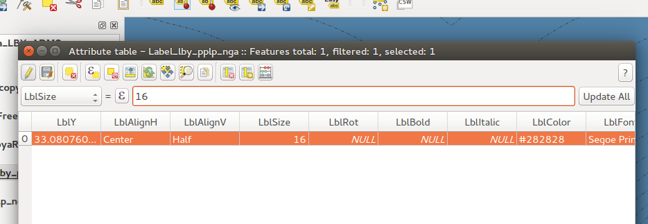
I know this may now seem like a big deal to most seasoned GIS professionals, but I have taught many intro to GIS classes and I have seen many people just getting their feet wet in a GIS program and not fully understanding how to operate a “Field Calculator”. I think that this method will make it much more user friendly since its very similar to MS Excel or LibreOffice Calc.
View Map in Color Blindness and Grayscale Mode
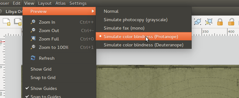
Now when I read that QGIS was including a method for you to simulate your map being view by a person who has Color Blindness, I was truly impressed. I have been asked soooo many time that I should create a map that is color blind friendly, and I have tried to comply with these requests. However, as many GIS professionals know, it is really difficult to style a map that is totally color blind friendly, but I know that this new feature will definitely help map better maps that can be view by all. Maybe, my old work place, Arlington County, can finely create a Zoning Map that uses colors and not just annotation and red dashed lines.
Finally, Composer Export Labeling Fixed
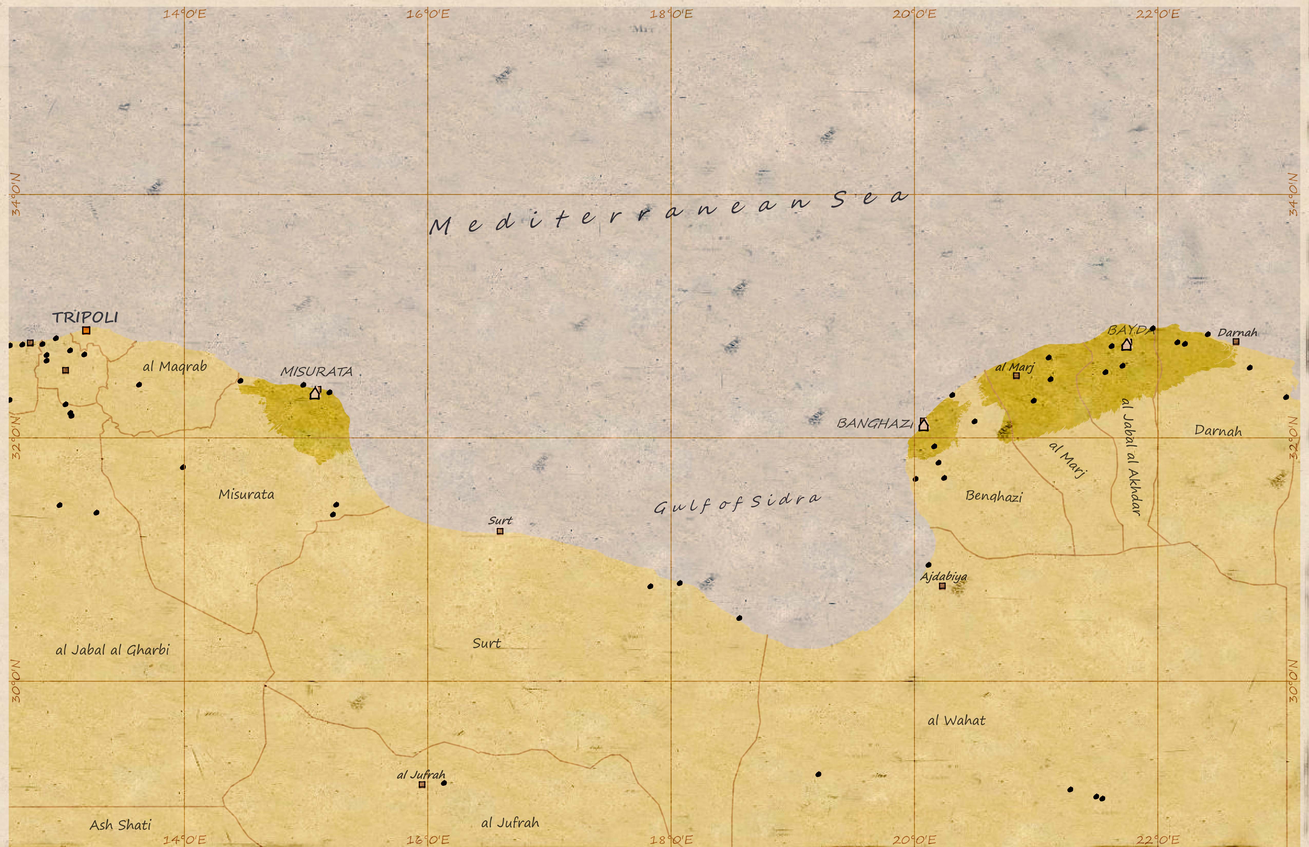
In one of my first post on Vintage Cartography in QGIS (post here) I noticed that my labels were not being properly drawn when I exported my map to a *.png. But I am happy to say that this issues is fixed, and it’s now working like a champ..

Final Thoughts
This next release of QGIS will be just as impressive as the past release. When I first started using this open-source desktop GIS software, it was a little buggy. However, with each release the software become more and more stable. I think that it’s truly becoming a strong competitor to ArcGIS Desktop, and its certainly MUCH cheaper. I enjoy working with it and I hope that these strong updates keep on coming from the QGIS development team. Cheers!
you have missed one of the greatest features… multi-threading for visuals. see a nice video here: http://vimeo.com/87762709 .
Ressource is here: http://changelog.linfiniti.com/qgis/2.4.0/entry/multi-threaded-rendering/
Wow that’s fast!
[…] Digital Geography […]