The release of QGIS 2.6 is planned for October 24, but you don’t have to wait to test new functions in development.
In this post I’ll look closer on two new features that in my mind will make GIS life easier, even if some improvements should be made with the first of the new features described here.
Independent Grid (Print Composer)
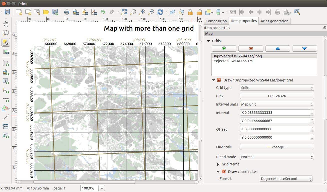
To me, this is proof that you can change things by reporting bugs and requesting features. This is a feature that I’ve requested myself (among others – link), which now at least partly has been implemented into QGIS master (the name for the development version of QGIS).
Grids in the print composer can now be added independent of the projection of the map, and you can add as many grids you could possibly want.
However, be careful when you pan the extent of the map to close to the projected grid boundaries. I’ve crashed QGIS quite a few times this way.
In my feature request, which now unfortunately has been closed, I also requested a way to format the grid labels so that a definable number of most and least significant digits could be omitted. This way I wouldn’t have to print “6582000” when “82” would be enough, as long as I could include a complete coordinate label in one or more selectable corners (so called corner labels).
Anyway, this is in my opinion a great improvement to QGIS Print Composer.
(By the way, can you spot something weird with the lat/long grid in the picture above?)
Colour Picker (I’m using the Queens English)
The new colour picker will make it a lot easier to select colours, especially to re-use previous colours.
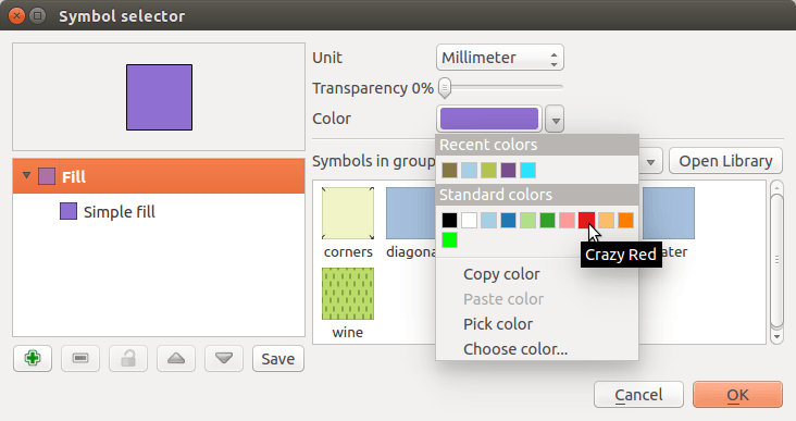
As before you can pick a colour freely by clicking the colour button, but the right-click menu has been removed. Instead you have a small button to the right of the colour that gives you the option to copy and paste as well as select from recently used colours or a set of “Standard colors”.
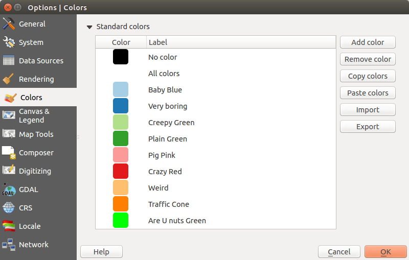
The standard colours can be edited in the settings ( Settings – Options ). Not only can you add and remove colours, you can also name them to your content. Your personal standard colours can then be shared by import/export functions (GIMP Palette *.gpl).
Changing colour names may not be revolutionary, but I think you could at least provoke a smile or two.


The color picker improvements also allow you to enter a color scheme/palette at the project level (in addition to QGIS’ standard colors list). You can edit that list in Project > Project Settings … > Default Styles tab.
It’s actually quite nice to have this option so as to prevent project-specific colors from leaking onto other projects (and taking space in the standard colors list).
Hi Klas,
Do you mind filing an issue (preferably with a sample project) about the crash you get when panning maps with grids? Should be an easy fix if I can get a reproducible test case.
And I’ve got a fix already inbound for that other little issue 😉
Nyall
60 minutes?
That’s a really significant advance for QGIS, the ability to specify the CRS of the grid overlay in Print Composer – many thanks for sharing it Klas. It also overcomes the existing problem of not easily being able to have a metric scalebar (say, km) at the same time as a geographic grid (i.e. in degrees). All of this makes QGIS an increasingly viable answer for good cartographic output.
And the ‘recently used colours’ option will certainly be a time-saver.
Indeed, 17°60′ is rather weird!
And the new Qgis will also allow to add HEX colors code, from a echancement request that i filled 3 months http://hub.qgis.org/issues/10814
may you prepare a simple data set or procedure to replicate the crash with the composer? obviously opening an issue in qgis. Should be good fix it before 2.6 release. Regards