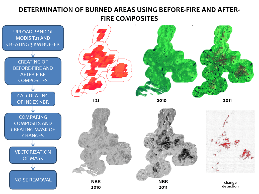
Using the Google Earth Engine (GEE) for Detection of Burned Areas
Google Earth Engine ( GEE ) is a cloud platform for processing satellite imageries. This service includes images of Landsat 5, 7,8, Sentinel 1 and Sentinel 2. You…
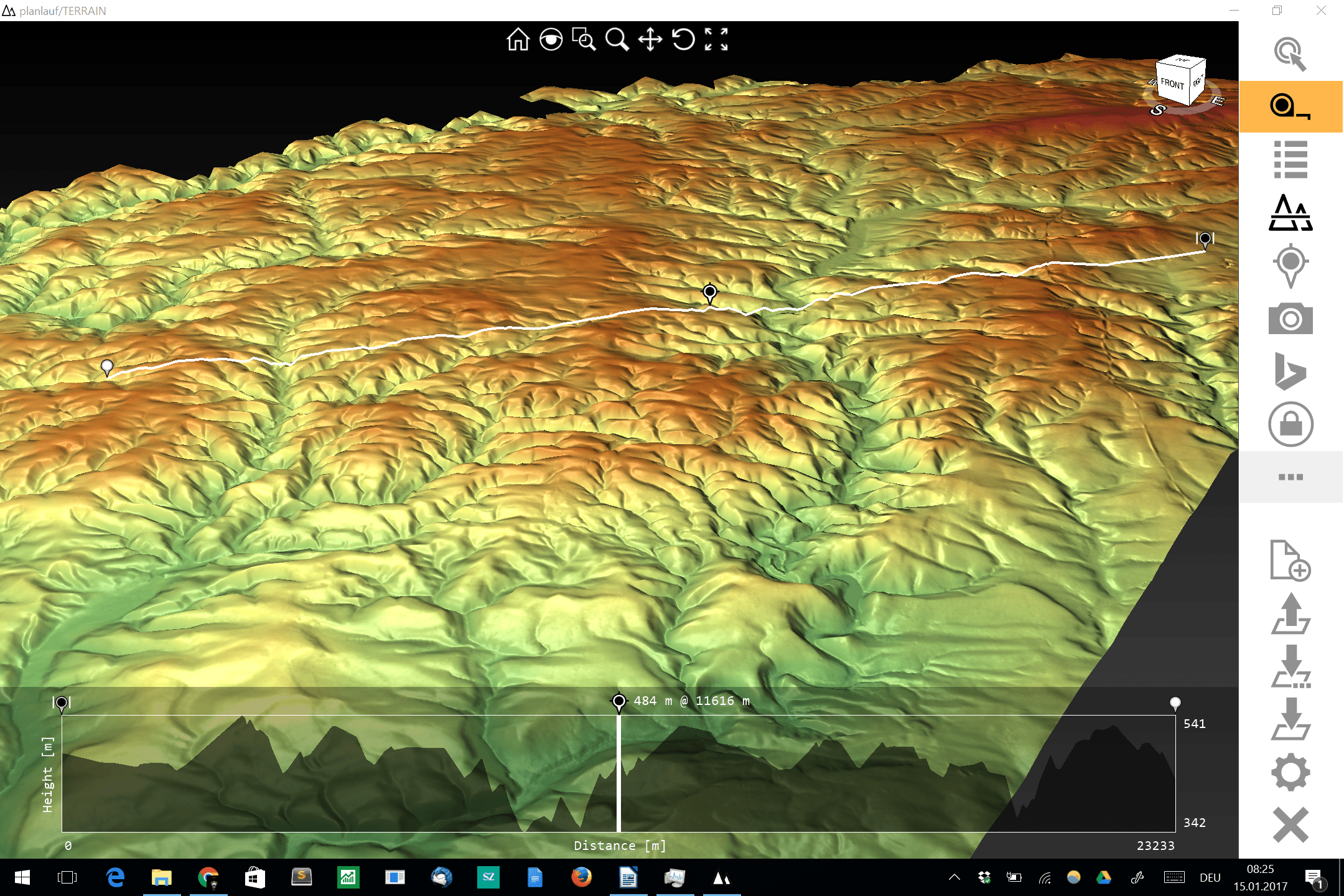
The visualization and interpolation of 3D terrain (point) data (DEM or DOM) could be a hard task for current GIS software and small to midsize hardware. One thing…

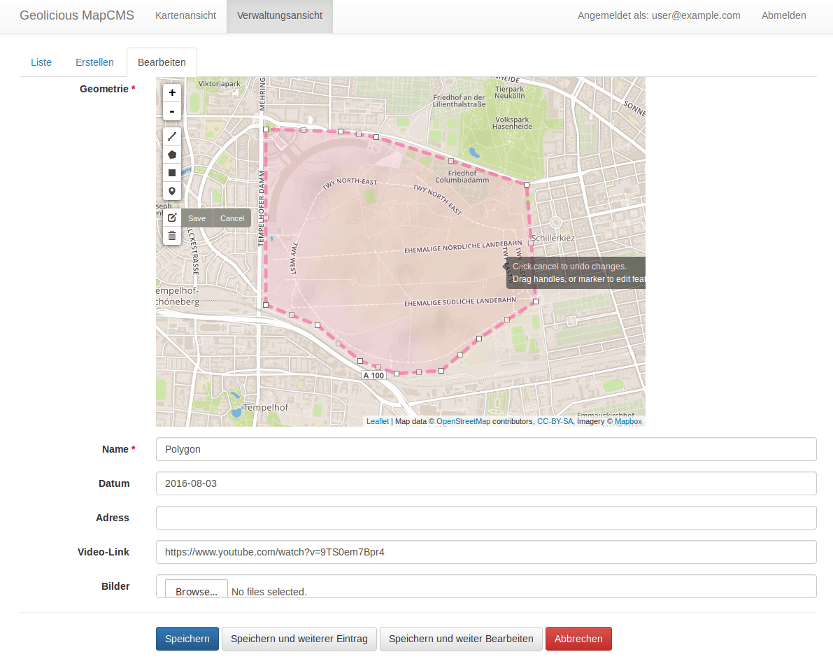
As I realized that I have a really huge family I was keen to digitize the current family tree and get into contact to my relatives. For getting…
This post is just a quick update on a unique event unfolding in my home state of Alaska and a cool new tool to help you post image…

There is this time of the year when the presents are unboxed and the new year hasn’t started yet, when a lot of people (including me) find some…
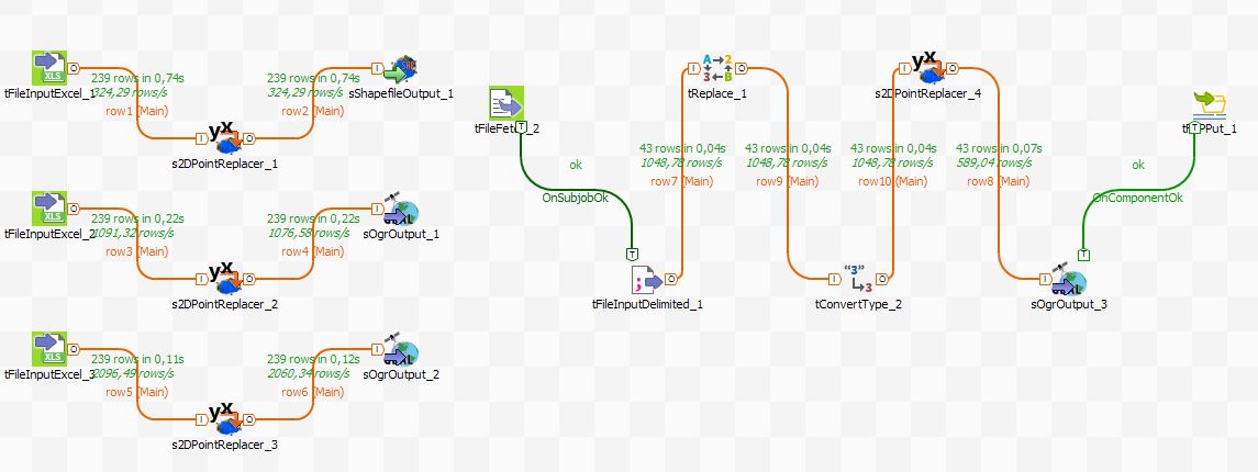
Over the last couple of years, we have seen an increase in demand and offerings of geospatial solutions in the cloud for tasks like web map creation, centralized…
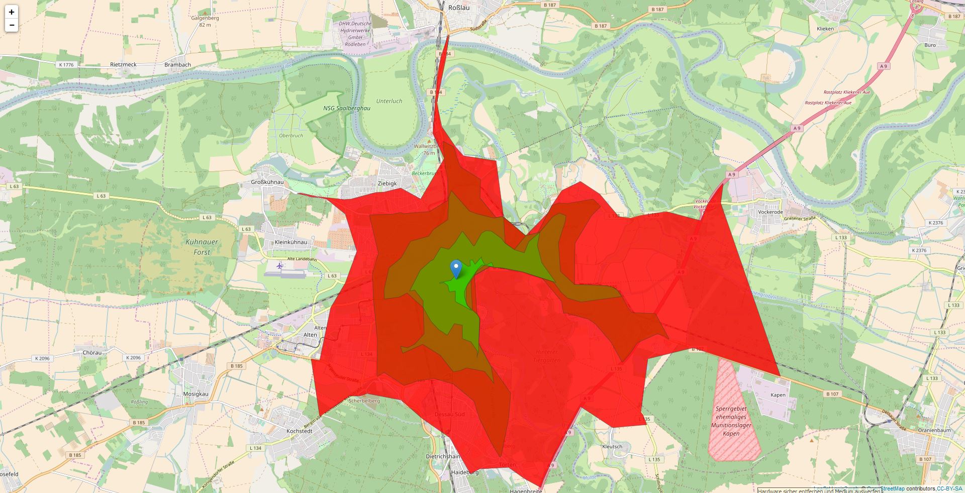
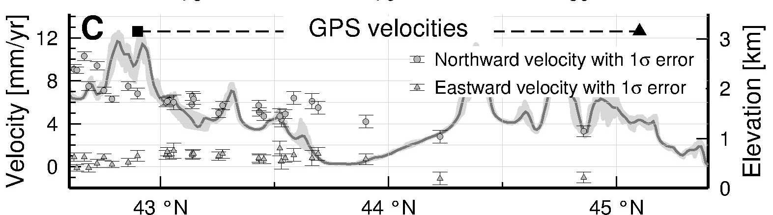
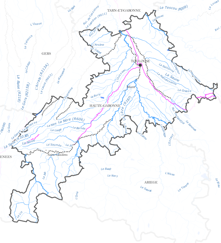
For a geomorphological study that I am working on I want to produce topographic swath profiles across a mountain range, that is, I want the average elevation along…
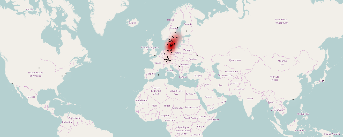
While preparing for an upcoming presentation at the annual meeting of the American Geophysical Union (AGU) I came across a topic that I thought might make an interesting blog…