 I have often wondered what could be the purpose of these mapping 3D models more and more accurate for major cities of the world (eg, Monaco, Geneva or Dubai).
The level of detail provided by the standard City GML even imagine the level of detail taking into account the interior (Level Of Details-LOD4) architecture, street furniture, and even the vegetation with its growth and seasonal aspects . Applications in architecture and urban planning are obvious, but beyond …
These models increasingly geographically and geometrically accurate (absolute GPS positioning errors of the edges and vertices of the order of 5 to 10cm required on certain specifications) cost a fortune and it is questionable how useful such accuracy.
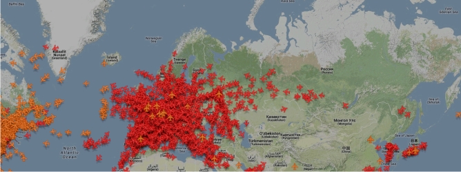
Meanwhile, we see more and more websites offering real-time tracking of moving airliners or offshore boats and hear more and more about the famous Google Car guided both by GPS and embedded sensors allowing real-time analysis of the immediate environment of the vehicle (obstacles, other vehicles).
In short, real time vehicles tracking technologies are now a reality, and the challenge of accurate modeling and 3D virtual environment is one of the main keys to the future development of robots that populate (and populate already) our daily lives: drones, cleaning robots, automated guided vehicles, guides for visually impaired, etc..
In the end, we are developing a mapping that is so accurate that it will soon be more useful for our robots than for us!
We are gradually going closer to the end of the world.