In some countries, such as the USA and Spain, there is a very nice law that makes life easy for geoscientists. This law guarantees free access to a broad range of geospatial data like DEMs, satellite imagery, aerial photographs, ground use data, hydrological information and so on. In most cases, these data are made public via web-based GIS applications. These are generally rather slow, but allow to display a lot of different datasets. I did both my diploma thesis and my PhD in Spain and I really needed to find out about all the data available. I knew that they were out there, but I had to find them. Most of them are only available in Spanish, so I needed to learn some basic Spanish. This is easy as long as you stay in the geosciences vocabulary: Pleistocene = pleistoceno; georeferenciada = geo referenced etc. However, I thought it would be nice to have a list of data sources in one place, so here it is:
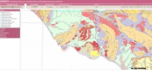
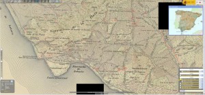
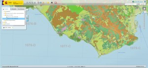
SIGECO
This page is available in English and contains even more data than you can think of:
- Hydrology
- Geophysics
- Mineral resources
- Drill sites
- Geochemistry
- Geological heritage
- Topography
- Geomorphology
- Geological maps
The color scheme is weird, but the data is great and you can download the datasets:
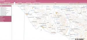
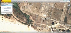
IBERPIX
Another great resource is IBERPIX, specialized on imagery and topographic maps, run by the Spanish Ministry of Geology and Mining IGN. It’s in Spanish.
You’ll find:
- Topographic maps
- Spot images
- 5m DEMs
- Geo referenced panorama photographs
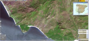
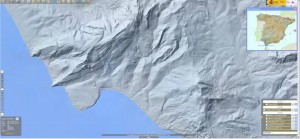
The maps are also available for 3d glasses!
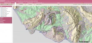
GEOPORTAL
The Ministry for Agriculture also hosts web mapping applications with an incredible amount of data. At GEOPORTAL, you can choose overlays with data on
- Agriculture
- Hydrology/water/water quality
- Geo heritage
- Tourism
- Business and forests
- Coastal data
- etc.
You need to be patient, loading takes a while and you need to have a Spanish dictionary. It is, however, absolutely worth the effort.
Very similar map services provided by the government with almost the same data are:
- SIGA
- AFOROS (hydrology information)
- SNCZI (hydropower)
- DPMT (Marine life, land register and Ortophotos!)
- BDN (Natural life)
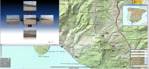
For all these maps you can also load the IGN Ortofoto overlay, which has some really nice aerial imagery. Some military installations are blurred, but then you can use GoogleEarth for those…
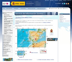
IGN earthquake data and more
If you are interested in earthquakes, I recommend to check the IGN pages. It’s also in Spanish.
You can access:
- Recent earthquake data
- Earthquake catalogues
- Gravity data
- Geodetic data and GPS stations
- Geomagnetic data
- Geological maps (and order hard copies)
- More aerial photos
- Volcano information
Yes, the IGN is also on Facebook, YouTube and Twitter:
IGME geoscience data
The Spanish Geologial Survey IGME (Instituto Geologico y Minero de Espana) also runs a website where you can find lots of geoscience data. It’s in Spanish and includes data on:
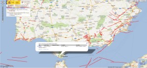
Quaternary Active Faults of Iberia
Even more earthquake data and fault data can be accessed at the QAFI – the Quaternary Active Faults Database of Iberia in English. This is really one of my favourite data sources, but this might be due to my personal interest…
Todocartografia
A good blog in Spanish on cartography and any related topics is todocartografia.
The end
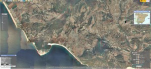
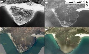
So, what is all that good for? Well, it’s geoscience disneyland for everyone working on a BSc., MSc. or PhD thesis in Spain. You have all the base maps more or less ready, you can load and compare data, and most of these services are for free. There are even different generations of aerial photos out there, which allow comparing fast-changing geological phenomena like mass movements and environments like dunes:
Unfortunately, the SIGPAC site has moved and so did the ICA of the Junta de Andalucía, but the data is till available via the GEOPORTAL. In Spain, it’s often a good idea to search the websites of the autonomous communities to find specialized geographical data…
References
- Grützner, C. (2011): The Baelo Claudia earthquake problem. PhD thesis, RWTH Aachen University.
- SIGPAC (2010): Sistema de Informacion Geografica de Parcelas Agricolas (SIGPAC), online GIS, http://sigpac.mapa.es/fega/visor/, Ministerio de Medio Ambiente y Medio Rural y Marino de Espana, last access: 2010-12-10.

[…] Geodades espanyoles per descarregar ; […]
Thank you for the great review. It will be very useful to me in the near future. All the best.