
Area, counts and data. This week became more tricky than ever. You faced the concepts of density and chorophlet maps. You were confronted with the MAUP and with some massive calculations done online.
The MOOC infrastructure
ATM approximately 500 out of 1200 students take actively part in the course. This is a shame as after the schedule was available the need for the course was obvious to many folks and now they need to wait. The course is going well and the tutorials in ArcGIS online are fine. Yet it is a little frustrating that cumming points in areas is consuming much time. You will get your result layers just after a while and once more the “sum within” layers are not added automatically.The MOOC content

Linda introduced us to the problem of layer analysis. so what is a union, a Venn diagram and what might be the best way to analyze the overlay of layers. But she also introduces possibilities to join by IDs. This was probably the case in the second lecture where we enriched data.

The second part is mainly focussed on the MAU problem. Basically it describes the problem how to treat data that is summed up to an area. It is obvious that you can’t use colors on population numbers and neglecting the importance of area. The color code is meaningless if you not show the area normalized value.
The last video is a guest lecture from Kenneth Fields who shows and describes common cartofails. Visit his great blog to see stunning cartographic works.
- color fails
- 3D fails
- too much points/pins
- data quality
- opacity madness
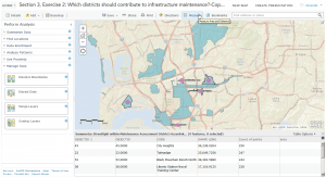
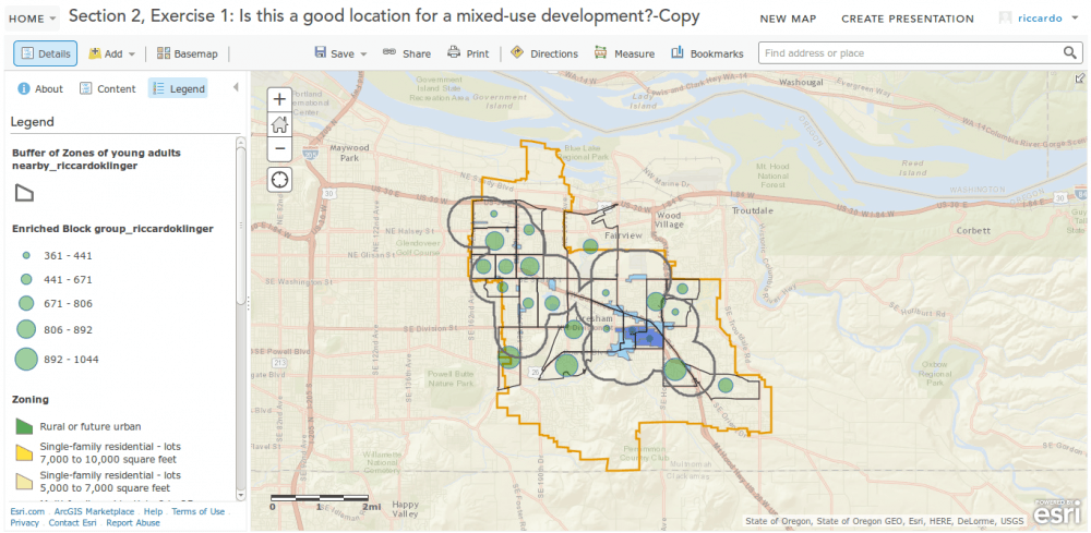
In the end you will have two exercises with ArcGIS online whereas both of them use a huge amount of data. to me this was quite unhandy and sloooow. But nevertheless you’ll lean how to summarize data in a given polygon/extend, make overlay analysis with intersects (why not union… ) for line and area results and you will furthermore alter styles and apply some filters:


What do you consider a huge amount of data?
according to the speed of summarizing some data it seemed that 100.000 point loactions was “a huge amount of data” 😉
I can load 1/2M points on AGOL but only in decade increment using time aware function. The whole lot loads AOK however on Mapcentia stack on AWS