The Copernicus Program provides an interesting alternative data source for your work with Landsat data… Sentinel images:
Copernicus will deliver an unprecedented volume of free data, provide new operational services and foster new business opportunities and job creation.
The data itself is collected since 2014 (Sentinel 1A) and the operation is scheduled to deliver data till 2020 at least. But how to get the data into the GIS of your choice.
The Semi-Automatic Classification Plugin (SCP) allows for the supervised classification of remote sensing images, providing tools for the download, the preprocessing and postprocessing of images. Search and download is available for ASTER, Landsat, MODIS, Sentinel-2, and Sentinel-3 images.
Sentinel-data search via map
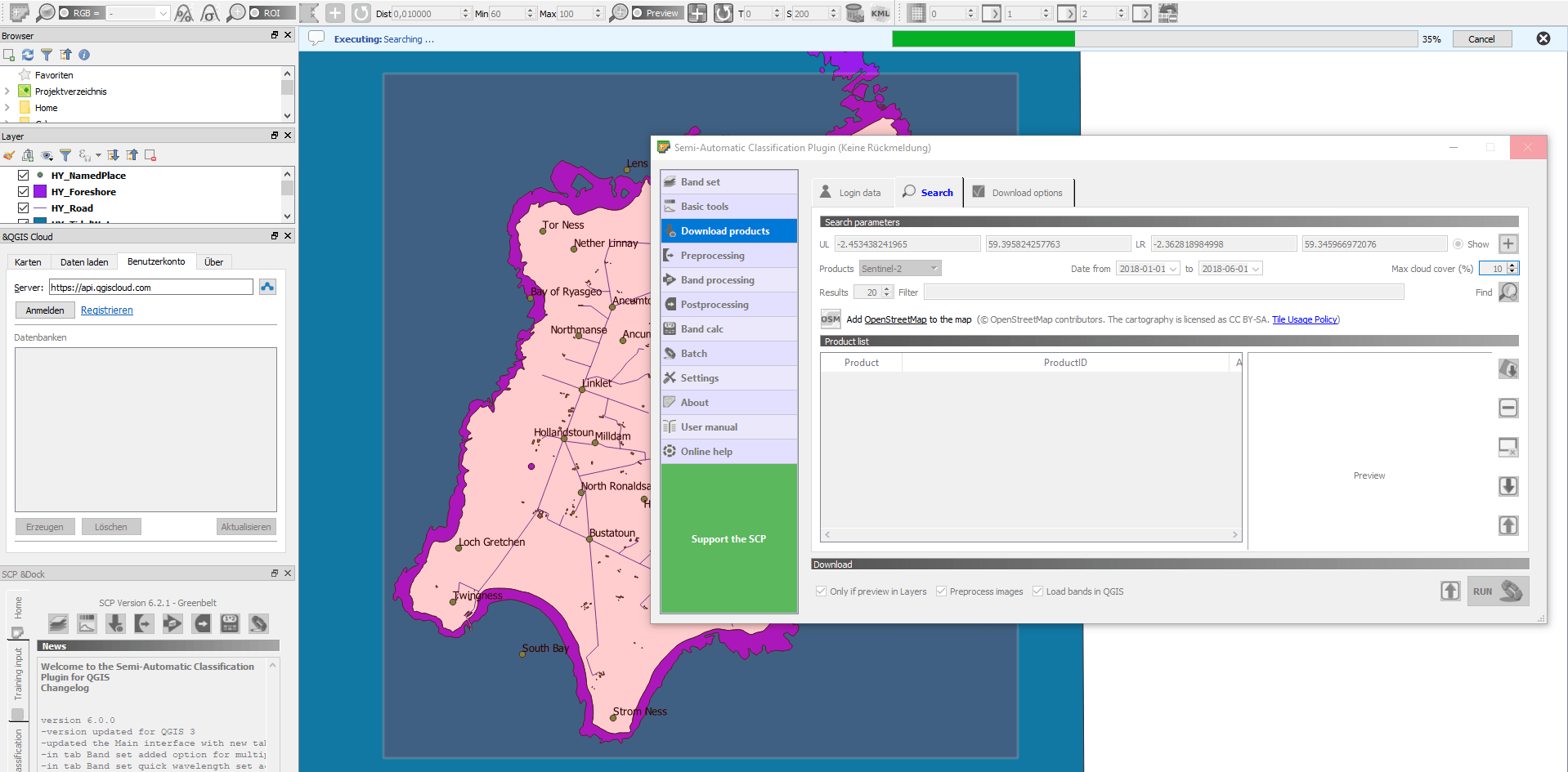
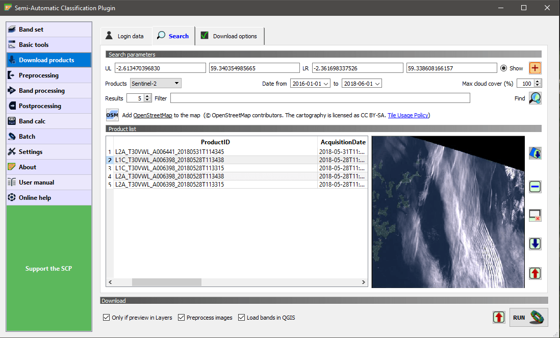
So use your Copernicus account inside the SCP plugin, select your area of interest, and click find. Of course you should decrease the max. percentage of cloud cover to your needs.
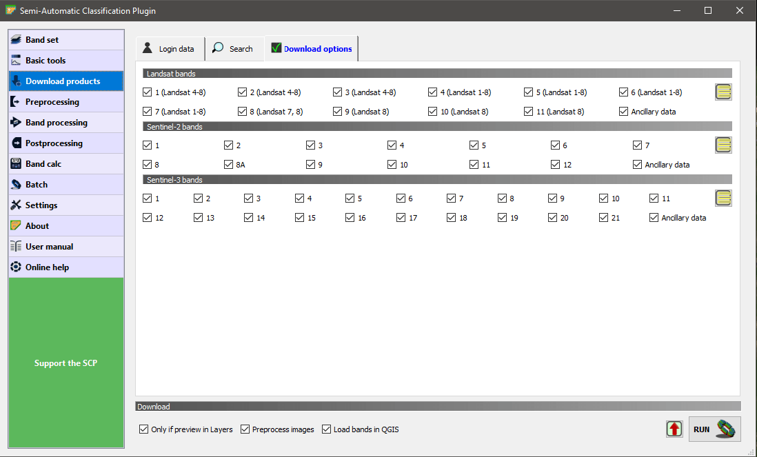
The data is downloaded as a tif file to your local pc. Once you have the data you can use them under the “Creative Commons CC BY-SA 3.0 IGO licence”:
credentials setting in SCP (QGIS3)
preview section for Sentinel images around the Orkney islands
download option (maybe choose just bands 1-2-3 for a RGB image)
RGB-Composition with the SCP plugin for QGIS3
Unfortunately the search, preview and download inside the plugin is very slow and also caused some error messages inside QGIS… If you want to see it in action:
Sentinel Data in ArcGIS
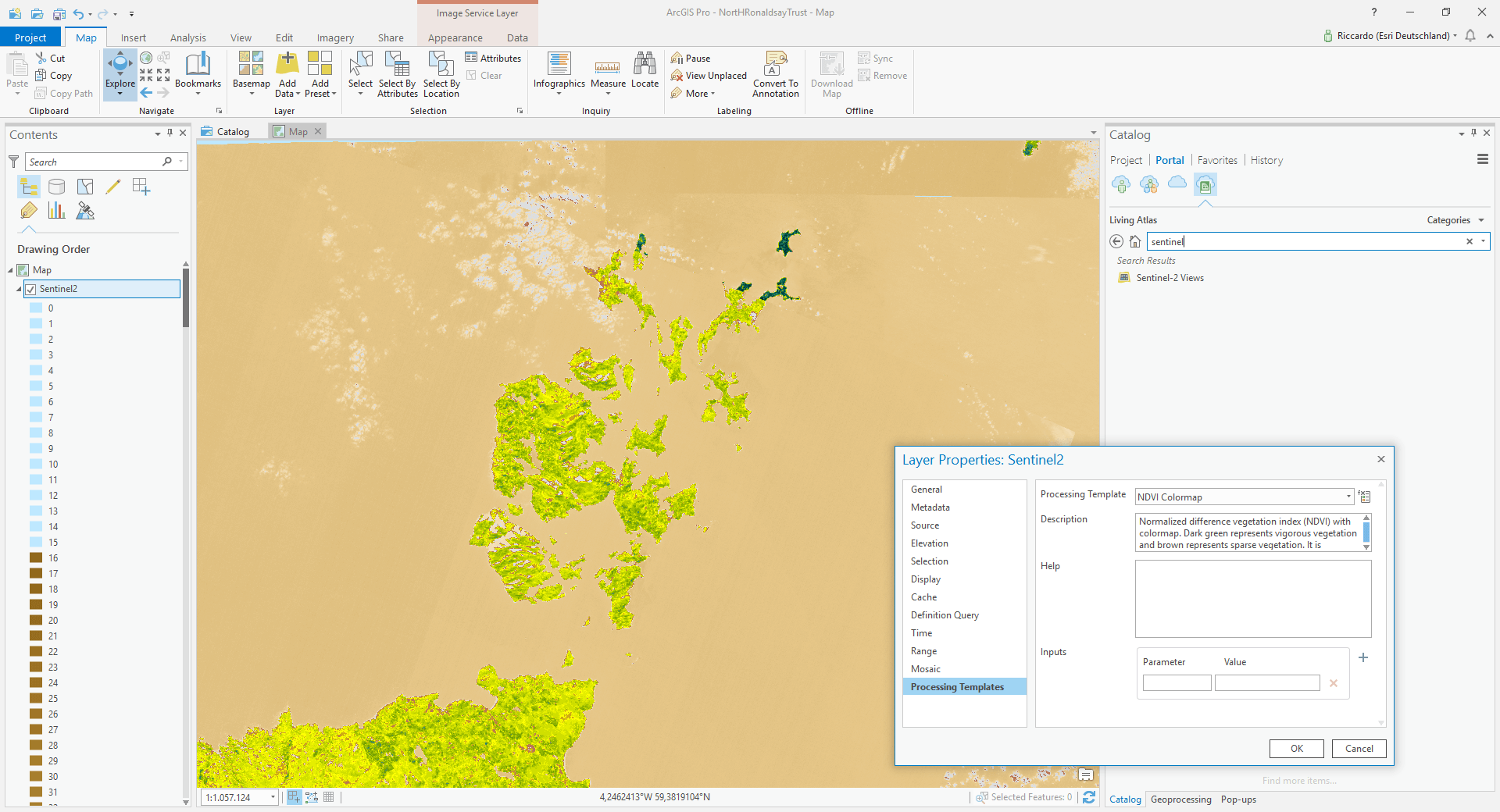
Esri announced, that they will feature Sentinel-2 images in their Living Atlas of The World. But you need some sort of account. Maybe you use the free of charge developer account to view the data. Yet this data collection only serve the RGB-combination. It is available in your Portal-item in the Catalog in ArcGIS Pro/ArcMap:
Sentinel-2 Views in ArcGIS Pro
As you can see, part of the view: all scenes are available but hard to filter. Yet the meta-data of these scenes seem to be “not defined”. That makes search quite hard. But keep in mind:
The ArcGIS Living Atlas of the World is the foremost collection of geographic information from around the globe. It includes maps, apps, and data layers to support your work.
So if you want to get a real inside and not only “support” you might want to use the Data collection with preprocessed data:
Imagery services in ArcGIS Online.
So it possible to select the image service and define the processing template inside the service in ArcGIS Pro.
Preconfiugured services are:
Short-wave Infrared with DRA
Geology with DRA
Natural Color
Agriculture
Bathymetric
Geology
Short-wave Infrared
NDVI Colormap and colorized
…
NDVI preprocessed data in ArcGIS Pro
If you’re still using ArcMAP the Download-Tools might even be a better fit:
ArcGIS Python Toolbox for Search & Download of Sentinel-2 data (L1C/TOA, L2A/BOA) via DHuS (Copernicus Open Access Hub a.k.a. SciHub, or CODE-DE).
Explore Copernicus Data in the Web
And if you want to explore the data in the web first prior downloading:
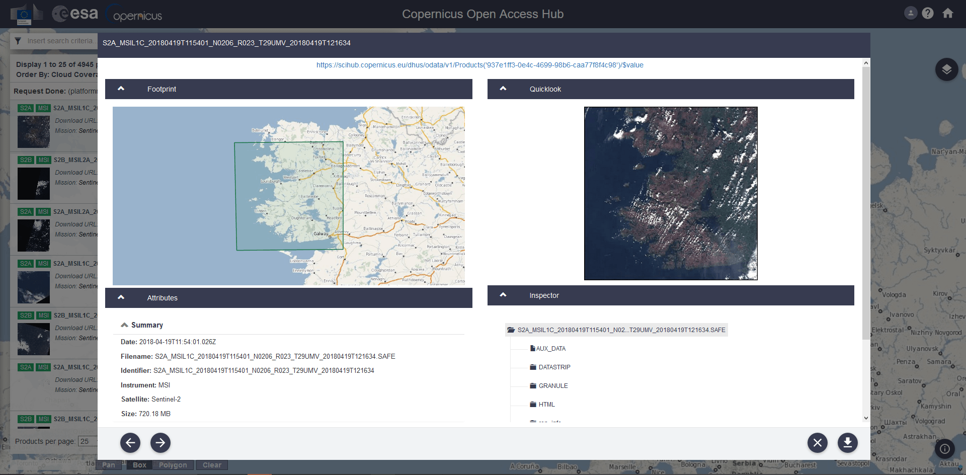
The Copernicus Open Access Hub allows you to define your search and also the download for desired scenes from Sentinel 1 to Sentinel 3:
Copernicus Open Access Hub
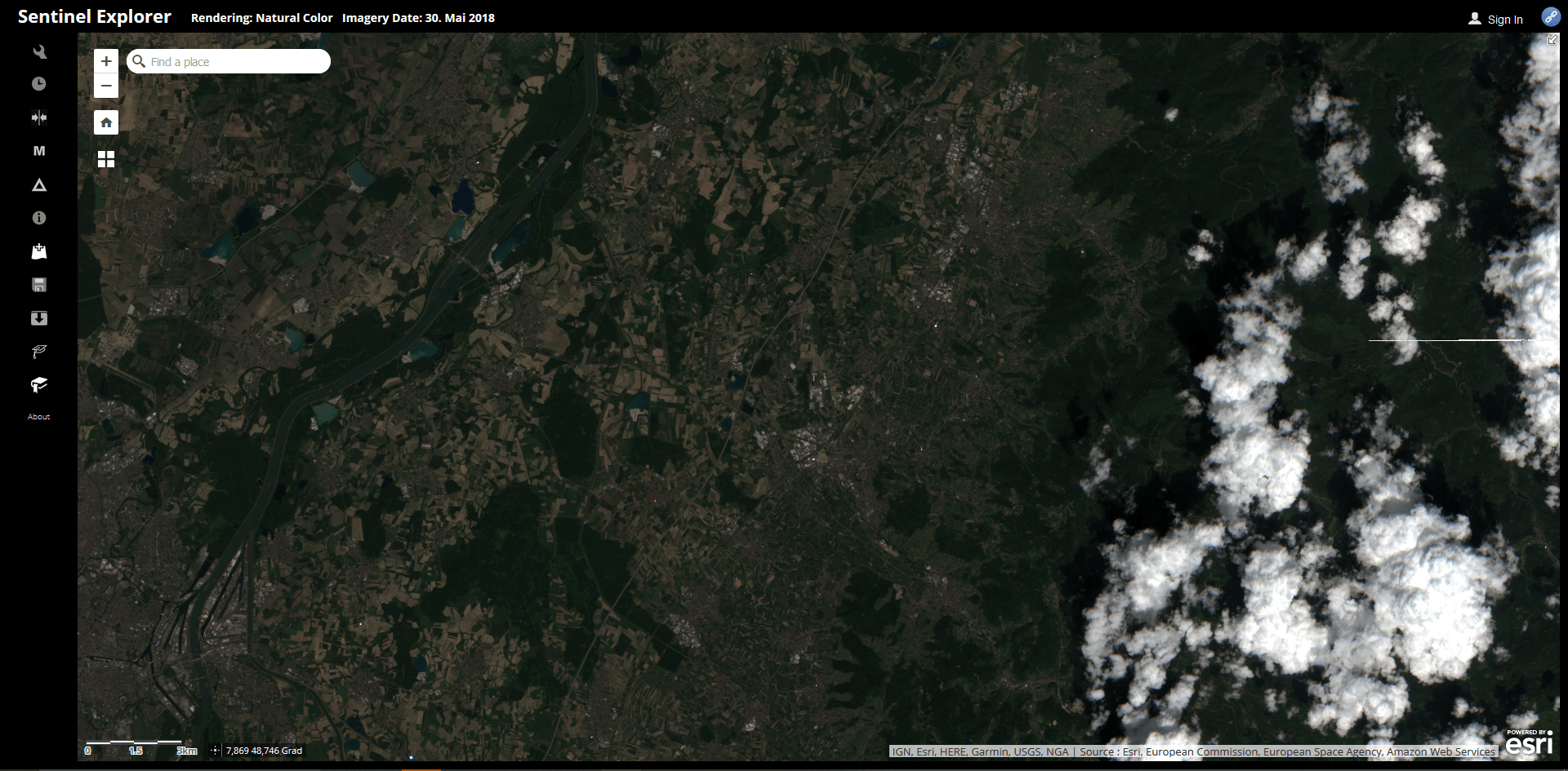
There is an alternate app for Sentinel-2 images only: The Sentinel Explorer.The Sentinel Explorer App from Esri
RasterCalc QGIS Plug-in QGIS is an open-source geographic information system that is familiar to many geospatial professionals. I find more and more that I’m able to use QGIS…
A short time ago I’ve posted an article on the installation of QGIS in combination with a PostGIS database in the background. As we all know, Windows is…