The last post with the focus on recent data for your work when it comes to DSMs or DEMs was a bit early honestly. I was working with the ALOS Global Digital Surface Model “ALOS World 3D – 30m” and I was comparing this with the SRTM 1 dataset for my beloved Kharkhorin area in Central Mongolia. So what is this ALOS model and how it performs?
ALOS 3D
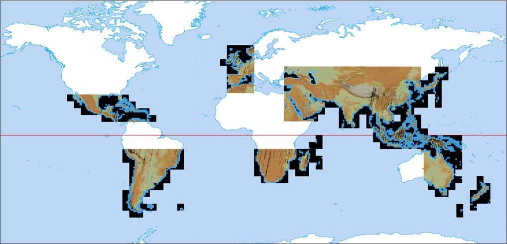
I was downloading this tile from an easy to use tile-map. As you can see the ALOS 3D 30m model does not cover the whole world ATM but they will provide more and more tiles in the future for free.
ALOS 3D 30m coverage
The data itself is based on images taken by the Advanced Land Observing Satellite “DAICHI” (ALOS). The satellite had a PALSAR (Phased Array type L-band Synthetic Aperture Radar) and a Panchromatic Remote-sensing Instrument for Stereo Mapping (PRISM) on board. The latter one was used for the DEM creation. Therefore you will find a lot of areas with striping in the above coverage. The main reason is probably cloud coverage. The raw data was used to create a stunning 5m DEM but was downsampled to a 30m DEM which is available for free (no specific license is mentioned on the website).
Comparing ALOS 3d 30m with SRTM 1: the data
As we already compared ASTER data with SRTM data I am curios about the performance of this DSM created using stereo images as it seems comparable with the ASTER approach: Taking images from two different angles and combining them to create a 3D representation. But correct me, if I am totally wrong. So lets get back to the data:
I am using the path 134 / row 27 and the SRTM 1 dataset downloaded from the EarthExplorer webpage (registration needed!).
additionally I am downloading a comparable scene from the ALOS webpage. The download consists of the average and median DSM and also a raster which describes the numbers of scenes used for a stripe. The mean value of stripes was 6.9 for the whole dataset.
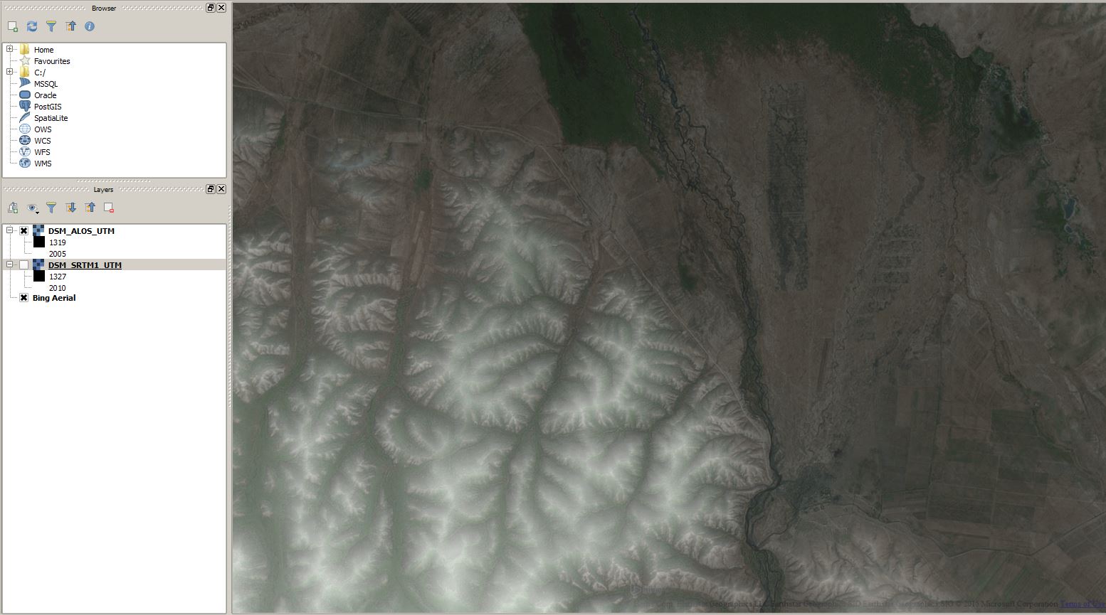
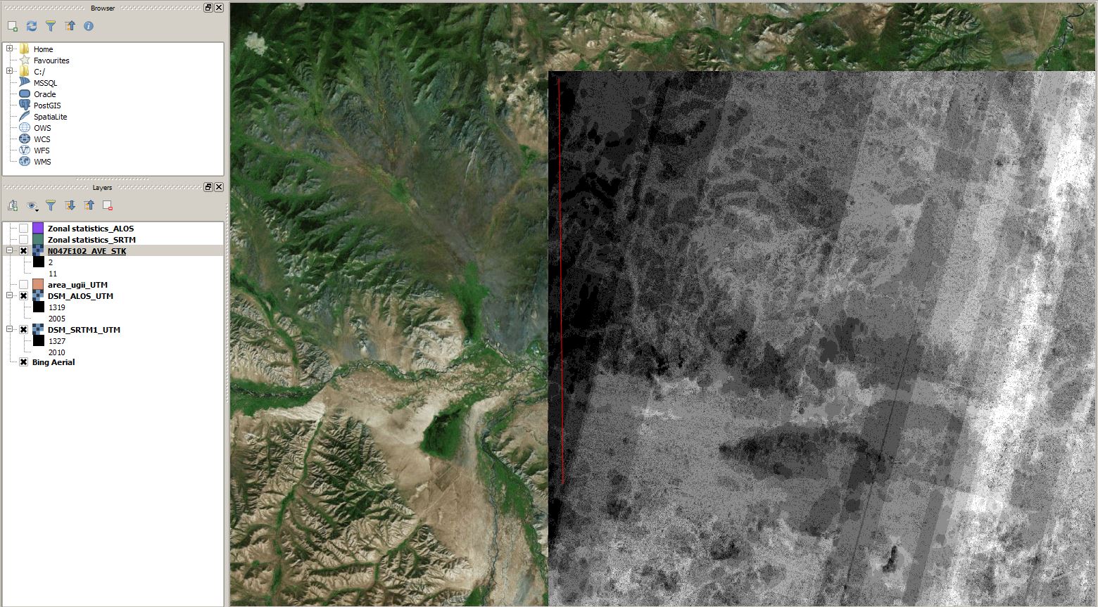
And by the first look after reprojecting them to EPSG:32648 I was quite surprised: the was nearly no visual difference between both datasets:
The ALOS 3D dataset with 25% transparency
The SRTM 1 dataset with 25% transparency.
The bing map with Landsat image.
Both datasets show comparable mean values which
Comparing ALOS 3d 30m with SRTM 1: the derivatives
First check the zonal statistics:
Scene
min
max
std
range
media
mode
SRTM
1266
2354
1412
1088
1495
1374
ALOS
1267
2360
1412
1093
1494
1373
Quite cool, nah?
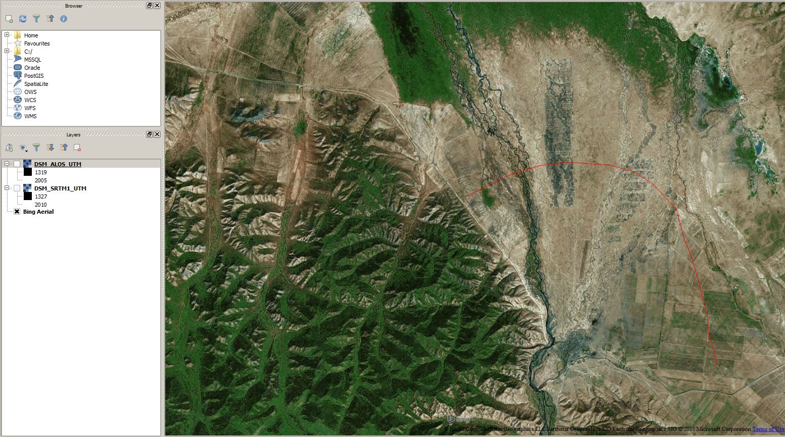
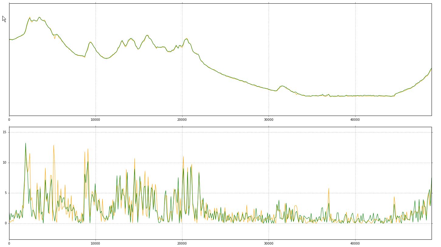
Okay, so lets check my lovely fan which was build up by the Orkhon river:
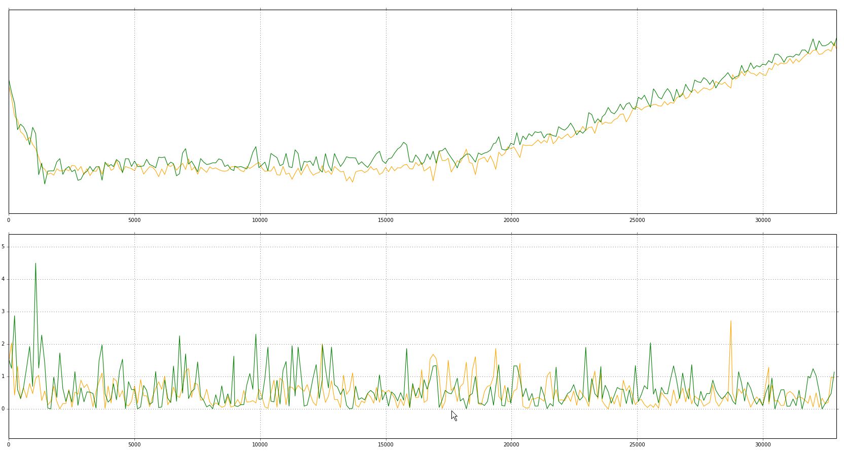
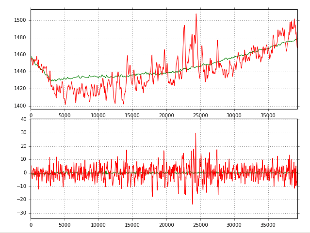
The fan with the used profile (tiny red line)And as suspected the height and slope values a quite comparable as well. Unfortunately the height profile below has the x-axis drawn with a log-scale.
profile with SRTM data (green) and ALOS data (orange): log of height in upper and slope values in the lower graph.
Both datasets perform quite good and are probably useable in a manifold of applications looking at the above results.
Comparing ALOS 3d 30m with SRTM 1: any disadvantages?
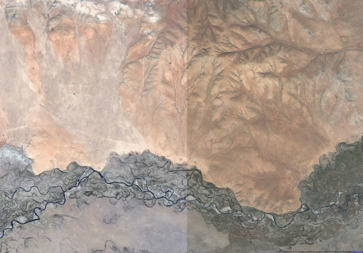
But let’s be honest: the fan was covered by a maximum amount of stripes (prob. high cloud coverages in a lot of scenes). So let’s check in areas with a low number of stripes:
area with 2 scenes in ALOS dataset
But once again the ALOS dataset did quite well:
log of height and the slope along the profile (SRTM-green, ALOS-orange)
The main difference can be found at 5.1km profile length where we can find a spike in slope values for the ALOS dataset.
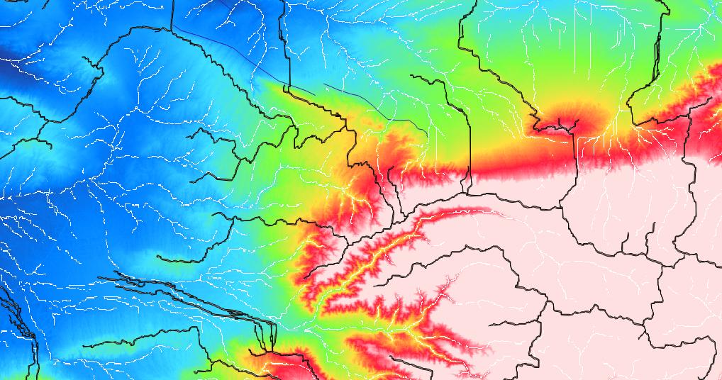
Now let’s check the slope at a wider scope. The SRTM data show some unsteady slope values in the flat areas which reminds me of some noise. The same is not visible for the ALOS dataset:
Bing Aerial, ALOS slope, SRTM 1 slope
As I know the landscape quite good I personally think the ALOS dataset is representing the current landscape much better than the SRTM dataset. But: the ALOS is a DSM and therefore maybe not usable in areas with undeniable vegetation coverage due to forests.
How about you? Have you worked already with this interesting dataset? What is your conclusion?
Personally I am looking forward the global release of this interesting and quite accurate ALOS 3D 30m dataset!
Many of us use digital elevation models (DEMs) for a whole bunch of different applications. There are some standard products which everyone should know, like SRTM1, SRTM3, ASTER,…
The White House announced on September 23th during the United Nations Heads of State Climate Summit in New York that they are going to release the high-resolution images…
Christoph already wrote an article about “How to find geospatial data for Spain” and also mentioned the IGME page but thanks to Mr. Nölte from the Dechenhöhle in…
Let’s get ready to rumble! No, just kidding. We are all excited about the recent message from the white house: SRTM “1” (1 equals 1 arcsecond, whereas 3…


I have just discovered my country is in the area already released, so I will do some work with this dataset and back to you. It looks so promising!
Thank you so much for your great article! 🙂