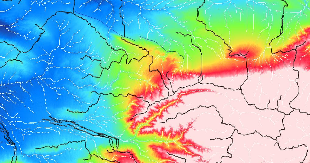
Some ways to produce high-res DEMs – tools and data
Many of us use digital elevation models (DEMs) for a whole bunch of different applications. There are some standard products which everyone should know, like SRTM1, SRTM3, ASTER,…
Many of us use digital elevation models (DEMs) for a whole bunch of different applications. There are some standard products which everyone should know, like SRTM1, SRTM3, ASTER,…
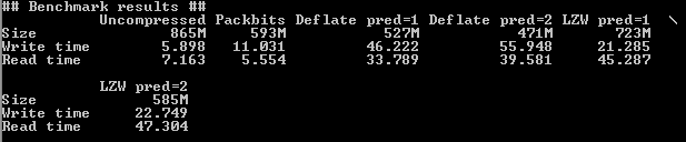
In remote sensing you often have to deal with large datsets because their spatial or temporal resolution is high. A typical Landsat 8 scene clocks in at 0.7…
Since we are still in the International of Year of Soils , another Digital Soil Science post is ready. Some of you might already know that I’m addicted to…
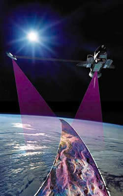
The White House announced on September 23th during the United Nations Heads of State Climate Summit in New York that they are going to release the high-resolution images…
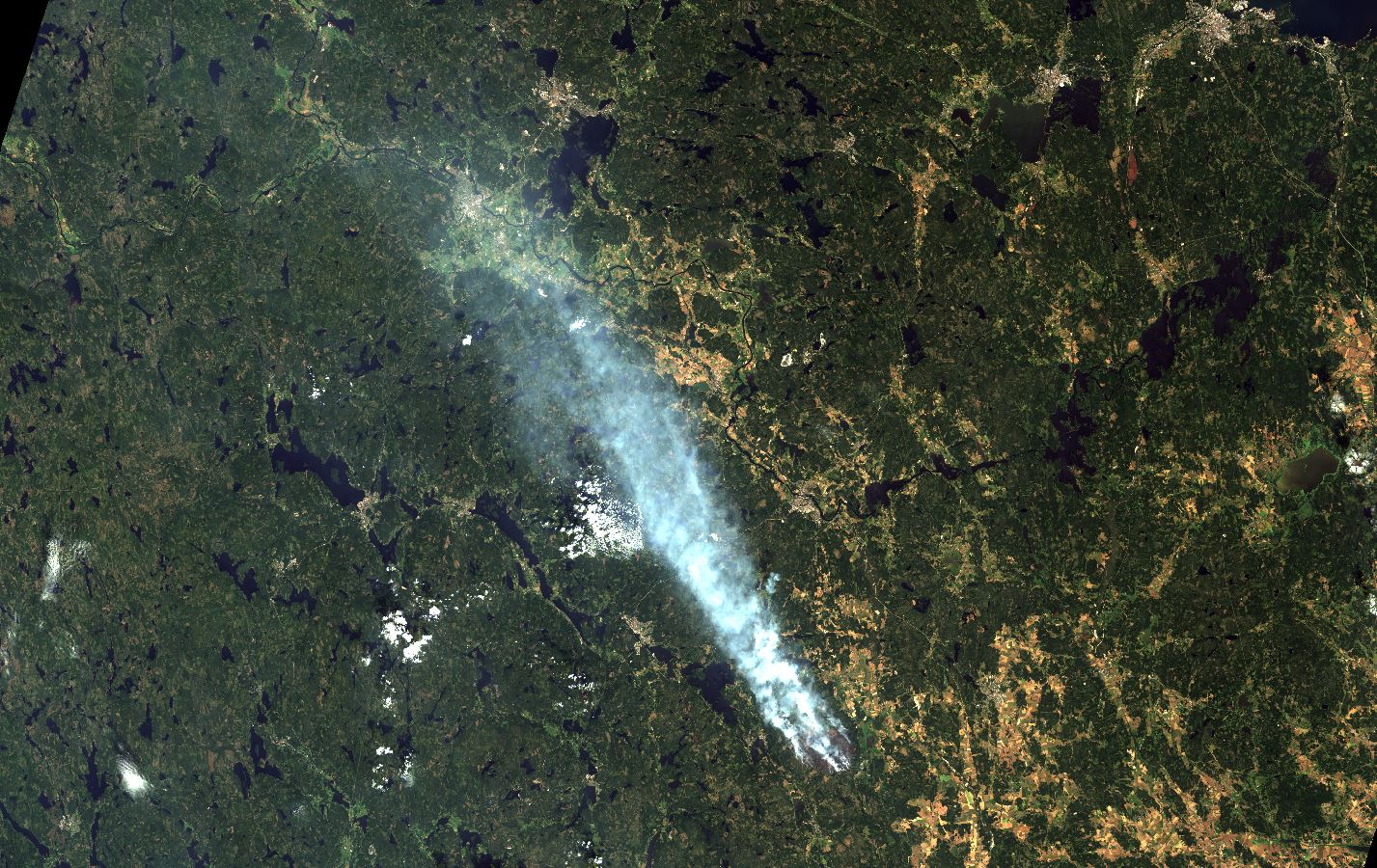
On July 31st a forest fire broke out in the Swedish county of Västmanland. The fire was quite large by Swedish standards covering an area described as 10…
The sub-title to this post could easily be “reasons to love DLR #123 (transparency)”. You’ll see why in a moment. In this post I am going to do…
Following sequestration and bitter budget wars in Washington NASA find itself in a difficult position. NASA has proposed a budget of $17.715 billion, down from $17.893B last year.…
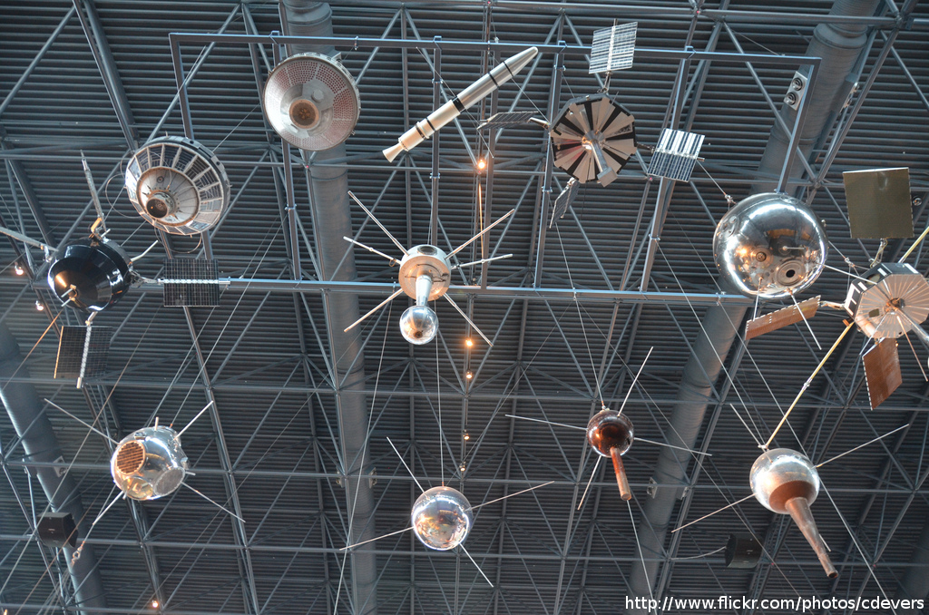
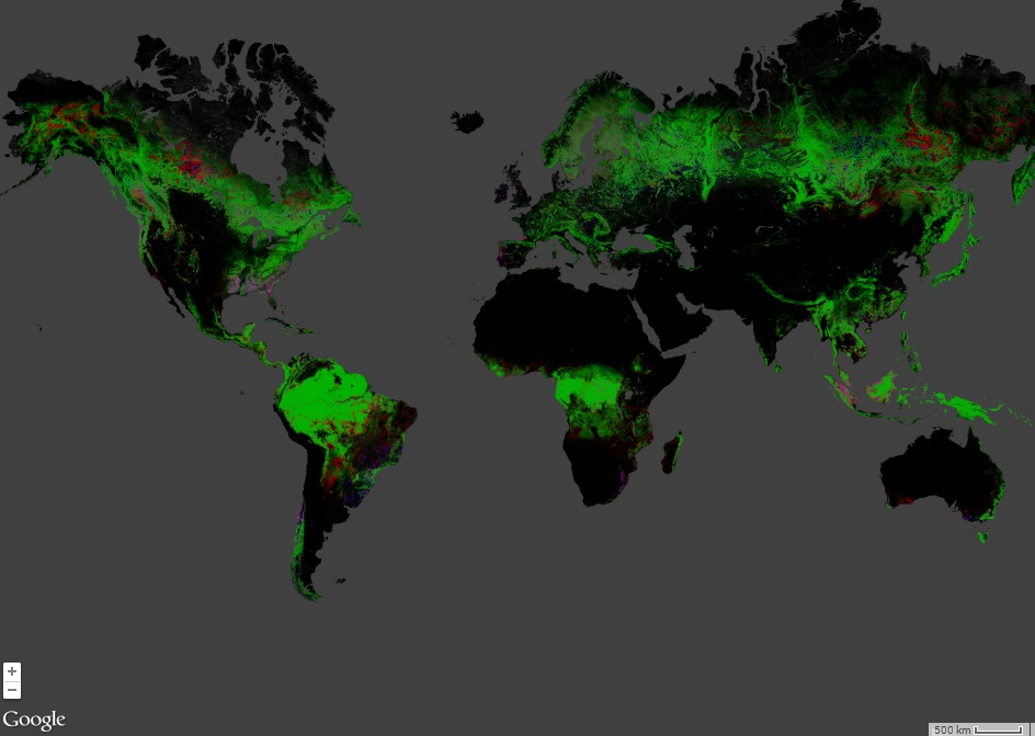
Since the start of Google Earth in 2001 (it was re-released in 2005 after Google acquired it from Keyhole, Inc ) remote sensing images made their way into…

In a previous post I talked about some of the remote sensing themes during the first half of the American Geophysical Union Fall meeting. Here I want to talk…
The Fall Meeting of the American Geophysical Union is one of the largest annual gatherings of scientists. Some 22000 have descended on San Francisco to discuss topics from…
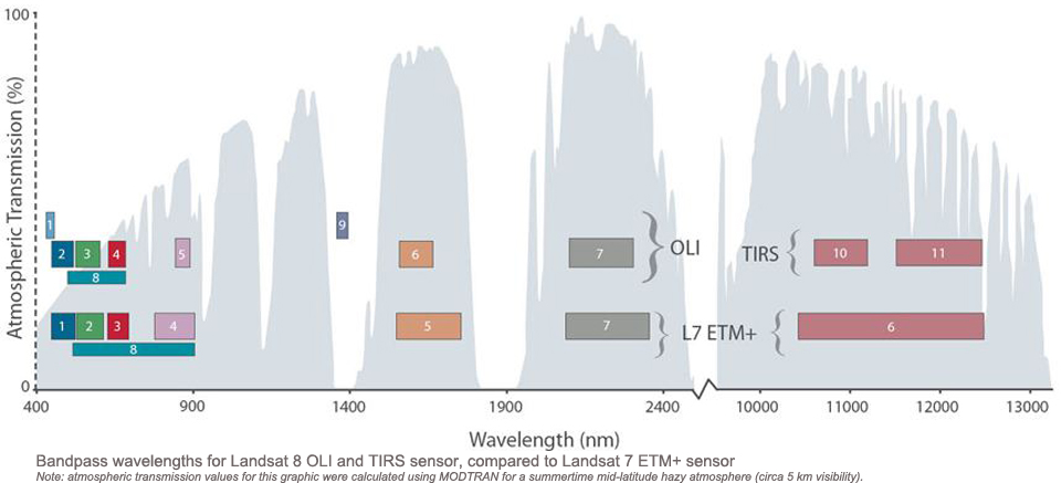
In my previous post I described the difficult process that led to the launch of Landsat-8. Here I will comment on the two sensors, the Operational Land Imager…