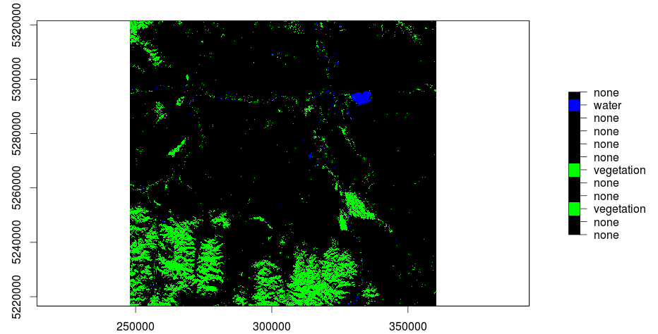
unsupervised classification of a Landsat image in R: the whole story or part two
The main question when using remote sensed raster data, as we do, is the question of NaN-treatment. Many R functions are able to use an option like rm.NaN=TRUE…
The main question when using remote sensed raster data, as we do, is the question of NaN-treatment. Many R functions are able to use an option like rm.NaN=TRUE…
In my last post I was explaining the usage of QGis to do a layerstack of a Landsat-scene. Due to the fact that further research and trying out…
Lets go one with the second part of learning R by doing R (you will find the first part here. As we have used vectors, matrices and loops…
Geography is often about statistics as it is the basis for fast exchange of information: providing a mean and standard deviation to the audience is often much easier…
Due to my work with a multitude of statistical packages in my career I may be able to evaluate a lot of them. I’ve first used Excel for…
When I am working in new institutions and I am asking: “Do you have a document management system?” I often get the answer:”Yap, we are using folders” ……
If I would like to adjust a shape file I normally used the way over an excel file or a text file to get a table and to…
Most of us R users are using a special working directory for the daily work in R. But I was bothered in typing everytime in my command line…
Unfortunately the qgis package is not available through the Ubuntu Software Center. Yet it is of course possible to install it. Just open the terminal and add the…
“Spatial data is, quite literally, everwhere” (Barry Rowlingson) this is so true! And because of that you guys will have the chance to take part in a great…