Four months ago QGIS 2.8 was released. The Long Term Release will be suppported for the next 2 years. Besides this LTR version QGIS is updated in a four month cycle. So let’s say hello to QGIS 2.10.
QGIS 2.10 “PISA”: changelog
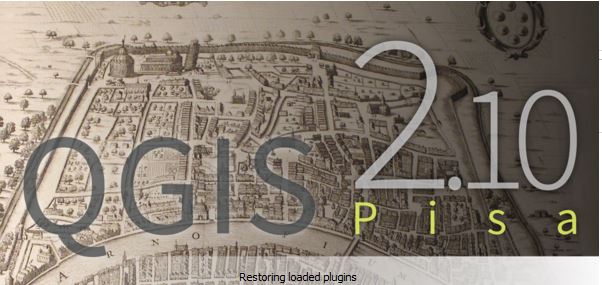
QGIS 2.10 “PISA” Splash Screen
With the new release we will see some minor and some bigger changes in QGIS. You can download it using the OSGEO4W installer and the Linux packages. Tim from linfiniti made a nice list of features on this changelog.
Let me list my favourites:
New zonal statistics features: The old build-in function only served a limited number of stats. This is providing way more freedom of choice.
Improved geometry rotation tool: it’s easier than ever to rotate vector data when digitizing. Especially for the guys in the field of line documentation (gas/oil/water/electricity) this might be helpful.
Layers with joins can now be filtered: I have to admit that I hate joins. I love it all in one file. But with this nice function you can apply a filter on the attributes of the “master” file.
Visualise and modify the graduated renderer using a histogram: A nice and convenient way of altering your colour scheme according to the visual distribution of data.
Live layer effects for layers and symbol layers: If you want to create stunning maps, this is definitely for you.
We have to thank the following persons:
Jürgen Fischer (norBIT) – Germany
Matthias Kuhn (OpenGIS) – Switzerland
Marco Hugentobler (Sourcepole AG) – Switzerland
Sandro Mani (Sourcepole AG) – Switzerland
Vincent Mora (Oslandia) – France
Nyall Dawson – Australia
But we should keep in mind all the testers and bug fixers around the world that help to develop QGIS to what it became today! Furthermore a thank you to the long list of sponsors.
A question on usage/ development
I am curious: How is QGIS used in the so called developing economies and “Newly Industrialized Countries”? Why is there no remarkable impact? I mean, there are loads of internet pages in Pakistan, India, Indonesia and China where you can talk about downloading and hacking products from Redland. But what about the usage of QGIS in those economies? Why is there only few development support from there? I am looking forward your comment below.
I live in Fiji and I work in 4 other Small Island Developing States. Your assumption that internet searches represent what people are looking at or using is misguided. In these SIDS work is done on a project level: when a project finishes there is no more funding for software/staff this is when FOSS software is used.
Hi, I’m currently in internship in small african archipel. People are very interested in software as Qgis and others open source solutions, meaning Inkscape, Gimp, Rawtherapee as free solution. Problems(my opinion) can be explained in several ways. Points mentionned by Jonah Sullivan, internet, and electricity are unfortunatelly true. I did the same as him, that’s to say : I came with data, installers, tutorials, laptop batteries…Then a problem is all tutorials or useful blogs like yours are more or less unknown due to the fact all stuffs are on the web. More, paperbacks available are so rare in Dev. Countries.… Read more »
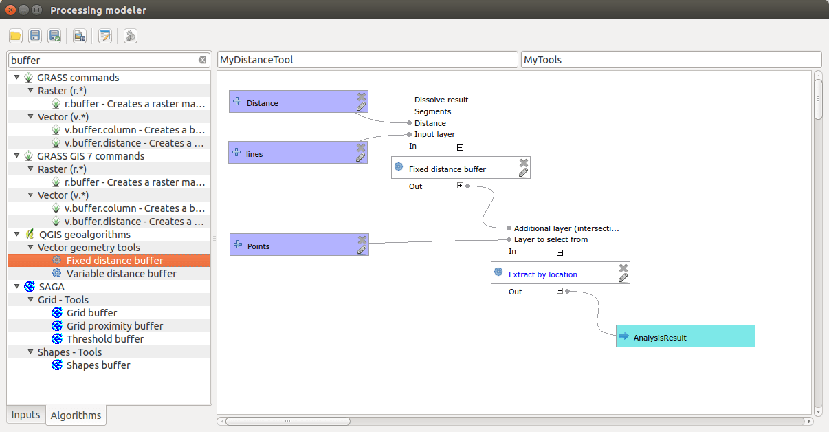
You’ve probably heard of model builder in ESRI ArcGIS (even used it?), but did you know the same functionality is available in QGIS? 0 0 votes Article Rating
Introduction In this post we are going to look at how to get weather forecast data and display it as a layer in a desktop geographical information system…
I live in Fiji and I work in 4 other Small Island Developing States. Your assumption that internet searches represent what people are looking at or using is misguided. In these SIDS work is done on a project level: when a project finishes there is no more funding for software/staff this is when FOSS software is used.
Deep blue for Italy 😉
Hi, I’m currently in internship in small african archipel. People are very interested in software as Qgis and others open source solutions, meaning Inkscape, Gimp, Rawtherapee as free solution. Problems(my opinion) can be explained in several ways. Points mentionned by Jonah Sullivan, internet, and electricity are unfortunatelly true. I did the same as him, that’s to say : I came with data, installers, tutorials, laptop batteries…Then a problem is all tutorials or useful blogs like yours are more or less unknown due to the fact all stuffs are on the web. More, paperbacks available are so rare in Dev. Countries.… Read more »
😉 my infographic https://flic.kr/p/vuss5E from source: http://changelog.linfiniti.com/qgis/version/2.10/
you need a better resolution. it’s hard to see!
Sorry, but disqus, load sample of image … al you can download full resolution in Flickr https://www.flickr.com/photos/city-planner/19356368806/in/dateposted-public/ You can give me a feedback if you can download 7000×15000 px resolution image?!?
works great!