
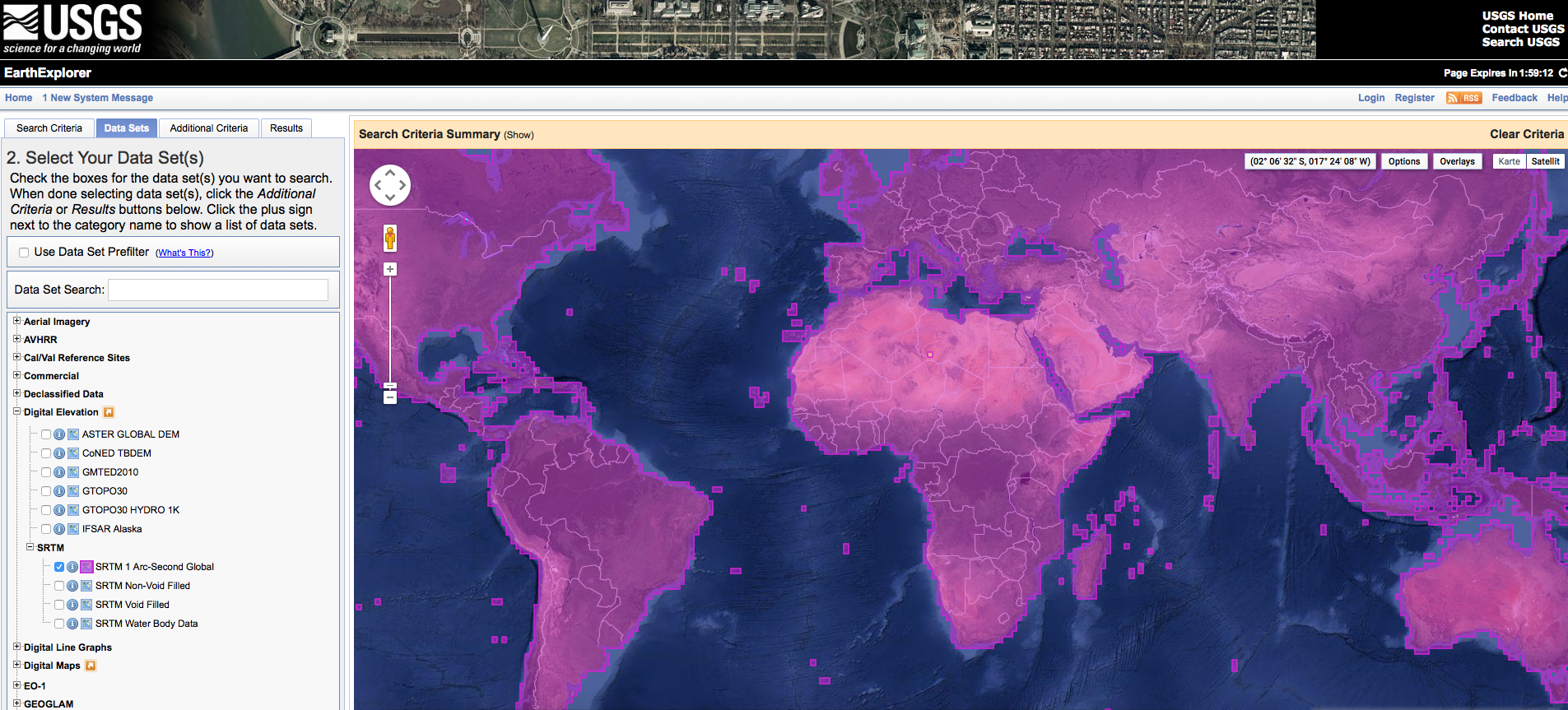
The White House announced on September 23th during the United Nations Heads of State Climate Summit in New York that they are going to release the high-resolution images of SRTM globally. Until now, the high-resolution imagery were only available for US-areas. All other countries had lower resolution imagery. Due to this release the 30m x 30m imagery will be available globally and substitute the 90m x 90m data. After its release the data will be accessible on EarthExplorer by the US Geological Service (USGS). Unfortunately they didn’t announce an exact release date (only “will be released globally over the next year”). That means we have to wait =(
Update: Kindly our user Felix Henselowsky asked the USGS for the exact release dates. Here they are:
- November 2014: Mexico, South America
- January 2015: Australia, Southeast Asia
- April 2015: North America, Europe
- July 2015: China, Japan
- September 2015: Northeast Africa
Background information about SRTM:
SRTM-datasets (Shuttle Radar Topographic Mission) are activ remote sensing data, obtained during an eleven days long Shuttle flight of Space Shuttle Endevour driven by NASA, DLR and others. The exact mission date was 02/11 to 22/02/20000. During this time the Shuttle had a flying attitude of 233km, sending 1700microwave impulses per second. The signals were reflected by earths surface and detected as radar echos.

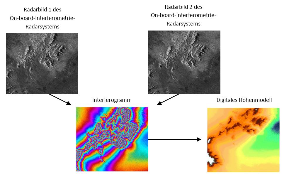
Due to a C- and X-band interferometry radarsystem two shifted imagery of the earth surface were compared using a “repeat-pass-interferometry-process” concerning elevation and relief. In comparison to other systems the imagery was produced at the same time by using an 60m displaced antenna (see image above). By analysing the interferograms Digital Elevation Modells can be created. A great advantage of such an active remote sensing system is the collection of data without depency on weaher or illumination (Schmidt 2011).
Source: NASA, SCHMIDT (2011): Implikation der Waldkonversion für das geomorphologische Prozessgefüge – eine GIS-gestützte Analyse der räumlichen Verbreitung von Bodenerosion in Mato Grosso (Brasilien), Hamburg (unpublished).
Update: I would like to use this article to add an innovative download-tool for quick SRTM-tile download. It’s much quicker than using EarthExplorer. Just check this Article.

Hi Simon, do you know about the Aster GDEM data in 30m x 30m resolution? I just downloaded some data for Switzerland from here: http://reverb.echo.nasa.gov/. Here’s more info on the dataset: https://lpdaac.usgs.gov/products/aster_products_table/astgtm
Hi Raluca, yap, ASTER GDEM is cool and stuff
but check out my short comparison: https://www.youtube.com/watch?v=QsCLcG9OWCA (for the picture: green is SRTM and red is ASTER)
Hi Riccardo, thanks for your fast answer… much appreciated because I spent about 2 hours tonight trying to figure out why my hillshade from this ASTER data looks so terrible…I noticed exactly the noise that you were talking about, but I thought I might be doing smth wrong and I could filter the noise somehow…but I guess I can give up then 🙂
I failed miserably with ASTER data 3 years ago and just wanted to give it a second chance but It seems useless…
what about GTOPO Data ??
is there any news about GTOPO? I thought its outdated and very coarse…
how to use the downloaded .zip file in arc gis, i’m a new one to use these all. Thank you
unzip it and import the tif to arcmap by drag and drop the file
Is a .tif file a raster file?
Yes it is: http://en.wikipedia.org/wiki/Image_file_formats#TIFF
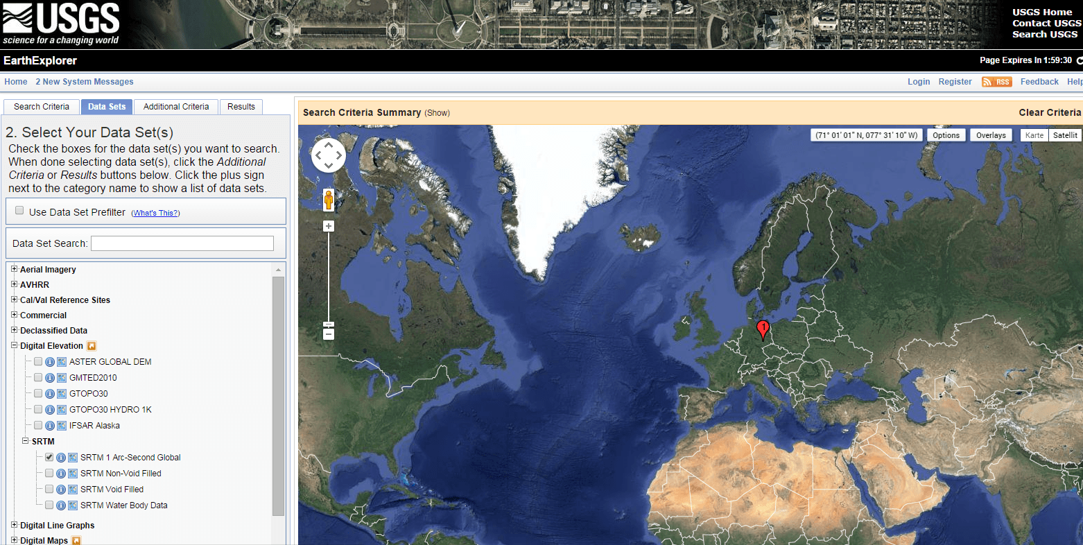
How can i download high resolution SRTM data of certain locality. I need the very data for watershed analysis in my bachelor thesis( hydropower project)
You can download the date on: http://earthexplorer.usgs.gov/
I need the DEM data of small catchment area for my study; i tried USGS site once but was tedious one. I need high resolution as much as possible
what do you mean exactly by high resolution? below 30m?
30m resolution is enough for our study.
I wrote an Open Source command line tool to download and clip SRTM 30m data, docs are here: http://elevation.bopen.eu/en/stable/quickstart.html
It is as easy as giving the following command:
$ eio clip -o Rome-DEM.tif –bounds 12.35 41.8 12.65 42
Hello, great info! A begginer question, does it need any postprocessing? I mean, I download the geoTiff, and then, can I use it straight away? Thanks
In general no post processing is needed. Sometimes you can get some correction files to improve radar artifacts in srtm data. It depends on your project goals.
What will be the release date of SRTM 30m DEM data for Indian subcontinent(southern Asia) ?
it is released already:
when will it be available for Africa? i mean 30m dem
Hi I need DSM for my study. Everywhere i find DEM. i need to understand urban built forms. Please usggest
i need 30 m for middle east.
how i can get it ?
you won’t get it as it is not released ATM
30 m resolution SRTM for middle east.
Hello, great Blog. Those data are beeing used experimentally in Outerra alfa Engine (great engine). And we are talking about in the forum. The OT developers say that it seems the data is smoothed. So the real resolution is far far from 30m. Is it that posible Simon? Is it there some way to get the Raw data somewhere? Because i dont know why goverment bother in get high resolution data and then smooth it until get much less resolution again. Here you have the link of the forum. If interested in see it or participate in it (for everybody).… Read more »
how to download it because I need this data for the current job I work
just read the article. Simon clearly says it is available here: http://earthexplorer.usgs.gov/ (might be blocked for you depending on your current location)
Hi I downloaded SRTM ( west coast of India n12_e075_1arc_v3, n12_e074_1arc_v3, n13_e075_1arc_v3, n12_e074_1arc_v3)
from earth explorer but image will be proper till i download but once it got downloaded it be changed…it looks simply a patch of grey. Please help me
Hi @ivysaviadantis:disqus,
the main reason is “contrast”! The data itself is probably right. Take a look at the contrast option in the program you are using and maybe try to define the NAN value to be equivalent to -32768. Best wishes, Riccardo
I think contrast is not a problem, because i opened the image in three different programs ( Arc Map 10, ERDAS 13 and Adobe Photoshop) but image remains same in all programs. Is there any other way to obtain SRTM data or DEM of India. Kindly help me.
how can i download srtm 90 database for my study are catchment
HI
I have a question…
as ASTER has already DEM data for all over the world in 30 m resolution, why is SRTM more popular and useful
?
Hi Saeede,
Aster is an optical sensor which creates a DEM out of photos from different angles. Therefore it needs a lot of photos which also needs to be cloudfree. The radar system used for the SRTM just don’t give a fuck about clouds: https://en.wikipedia.org/wiki/Interferometric_synthetic_aperture_radar
Hi , It is Known that 30mX30m resoultion DEM is released freely but even this data is not enough for small rivers which have width of less than this , is there a DEM file above 30mX30m i.e5mX5m 04 up to 20mX20m?