
ArcGIS Open Data
For a year, ESRI’s open data initiative is online. As I’ve heard about it for the first time I was just thinking: nice move to get people into…
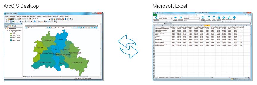
GISconnector for Excel – the beginning of a beautiful friendship between ArcGIS and Excel The GISconnector transforms ArcGIS and Excel into an ingenious overall system: The power of…
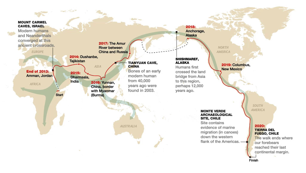
Today I had the chance to attend a lecture by Paul Salopek in Tbilisi, Georgia. This lecture took me to the idea to write a short review about…

When working with raster datasets, it is hard to keep an overview of the raster files in use and their coverage. Most raster data providers may keep metadata…
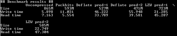
In remote sensing you often have to deal with large datsets because their spatial or temporal resolution is high. A typical Landsat 8 scene clocks in at 0.7…
Google recently made an announcement that left me very happy: Google Earth Pro, the enhanced version of the world’s most popular digital globe, is now available for free.…